Several smoke plumes emerging from the south of Peloponnese. During the summer of 2007 devastating fires caused the death of 84 people, severe damage in villages and even threatened the ancient city of Olympia. A total of 270 000 hectares were burnt of which 155 000 hectares forested. The image was acquired on August 24, 2007 by the MERIS sensor aboard the European satellite Envisat. It is a true colour image with a resolution of 300 m.
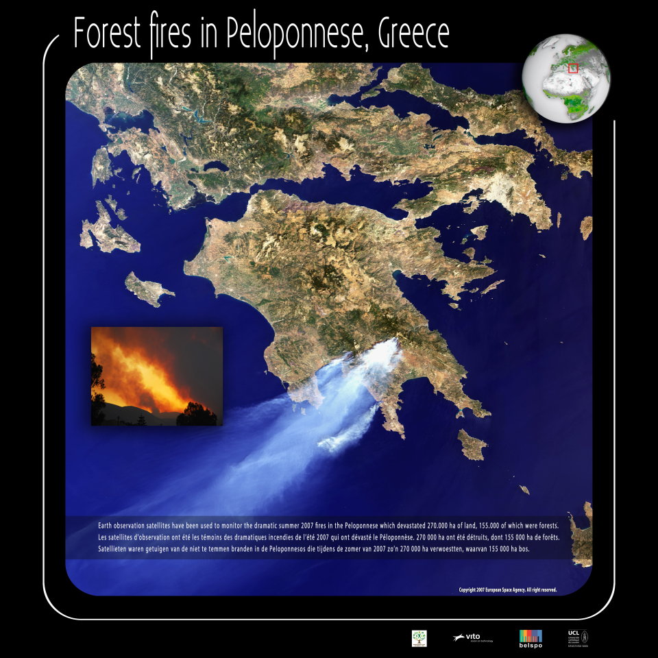
Earth observation satellites have been used to monitor the dramatic summer 2007 fires in the Peloponnese Which devastated 270.000 ha of land
In Europe, the five countries most affected by forest fires are Portugal, Spain, France, Italy and Greece. The statistics for all of these countries between 1980 and 2010 are impressive: every year, on average, 50 000 forest fires devastate nearly 500,000 acres of forest. The figures vary from one year to another since the fires are strongly influenced by meteorological conditions.
In the light of the risks and the extent of forest fires in Europe, the Joint Research Centre and the Directorate General Environment of the European Commission created the European Information System on forest fires. This system has two components:
An early warning system
Directly useful to forest protection services, this system called European Forest Fire Risk Forecasting System provides an estimate of the risk of forest fires based on weather forecasts, archived data and satellite images. The system is operational every year during the summer, the season prone to forest fires. The fire hazard is mapped at an accuracy of 40 km, each region of the European Union is classified into one of five categories (very low risk, low, medium, high, very high). These maps are updated daily and are accessible for all fire fighting agencies.
An estimate of burnt area
Operational since 2003, the Rapid Damage Assessment module can estimate burnt areas throughout the forest fire season. To achieve this, the module analyzes images provided daily by the MODIS sensor on board the Terra and Aqua satellites. The map, with a spatial resolution of 250 m, is processed within hours of its capture and helps to define the perimeters of burned areas over 40 ha.