Published on 29 July 2022
Hidden beneath the canopy of the Yucatán rainforest are the remains of a lost world, that of the ancient Maya. These remains, covered by dense jungle vegetation, escape our eyes on the ground, but are often clearly visible to sensors on airborne or satellite platforms.
Structures that were once hidden can nowadays be revealed by LiDAR (Light Detection and Ranging) laser scanning technology. By combining Pleiades tri-stereoscopic imagery and LiDAR point clouds, the project team of STEREO III project LIMAMAL has been able to develop a set of recommendations and guidelines for archaeologists who wish to use data fusion to study Maya archaeological landscapes.
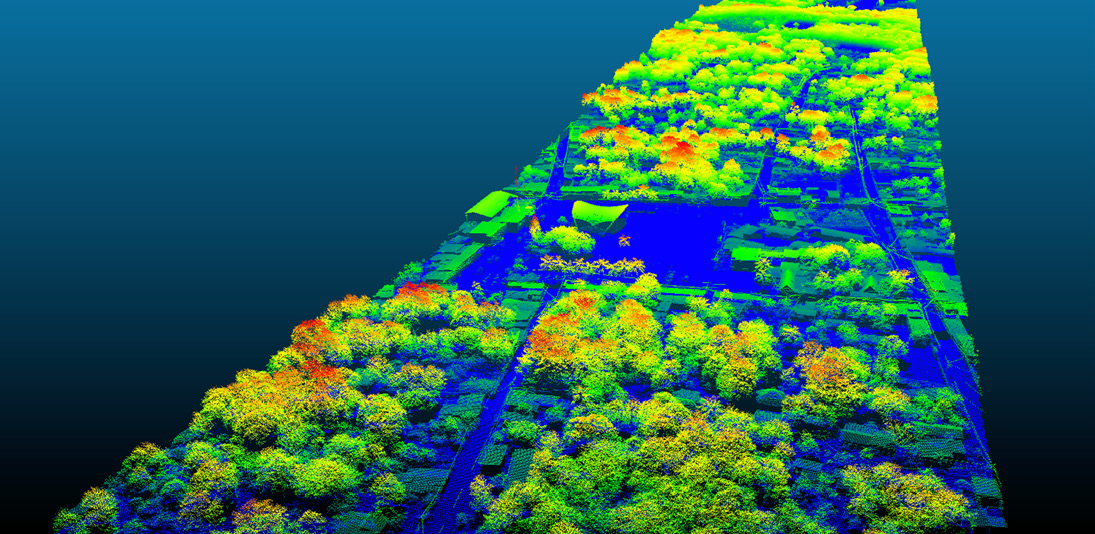
Point cloud over part of the Yucatan Peninsula. Colours correspond to height above the surface with blues representing ground and reds representing the tops of the highest objects (e.g. trees). Source: La iniciativa LiDAR aerotransportado de la Alianza México REDD+
Advanced techniques to probe the past
Many of us still picture archaeologists taking a kit with trowel, brush and magnifying glass into the field for careful excavation. But alongside this on-site work, researchers of the past can now benefit from a range of advanced techniques to prepare or refine their research. LiDAR is one of these new technologies that are helping archaeologists, in particular to reveal Mayan remains covered by the tropical forest. LiDAR is an instrument, usually carried in an aircraft, consisting of a laser scanner and a photodetector. The laser emits thousands of pulses of light that can penetrate the forest canopy through small openings, interact with the ground surface and return to the detector as an echo. These light beams can thus reveal previously unknown structures, allowing archaeologists to obtain information about areas about which they had little knowledge. LiDAR is therefore an important tool for the reconstruction of ancient landscapes and for a better understanding of the Maya civilisation.
|
What is a tri-stereoscopic image?Stereoscopy reproduces the natural process of our eyes' three-dimensional vision. The parallax between images acquired from different points of view makes it possible to reconstitute the relief of the scene observed. The optical instruments on board the satellites are often capable of scanning the same scene from different angles with a time lag of the order of a minute, which makes it possible to create a stereoscopic scene during a single pass. The Pleiades satellites are equipped with instruments that can acquire three images of the same area almost simultaneously, one backwards, one forwards, and a third image close to nadir. These images, known as tri-stereoscopic images, allow the reconstruction of very precise 3D models. Image source : Airbus |

 Combining LiDAR and very high-resolution imagery
The LIMAMAL project team, consisting of researchers from Ghent University, combined elevation models and visualisations derived from LiDAR data with very high-resolution tri-stereoscopic satellite images acquired by the Pleiades satellite constellation. With a resolution of 50 cm, these images can be used to discern major archaeological remains.
But the fusion of these data with LiDAR data provides archaeologists with much more detail and a better understanding of the archaeological landscape. Depending on the characteristics of the terrain features of interest, different visualisation methods can be used. Each method has its own advantages and disadvantages, some being better for finding features in low relief topography, while others are better suited for steep slopes.
At the end of the LIMAMAL project, a series of recommendations and guidelines were written for local archaeologists to help them achieve their goal of better understanding the structure of Mayan communities within a dense and inaccessible tropical forest ecosystem.
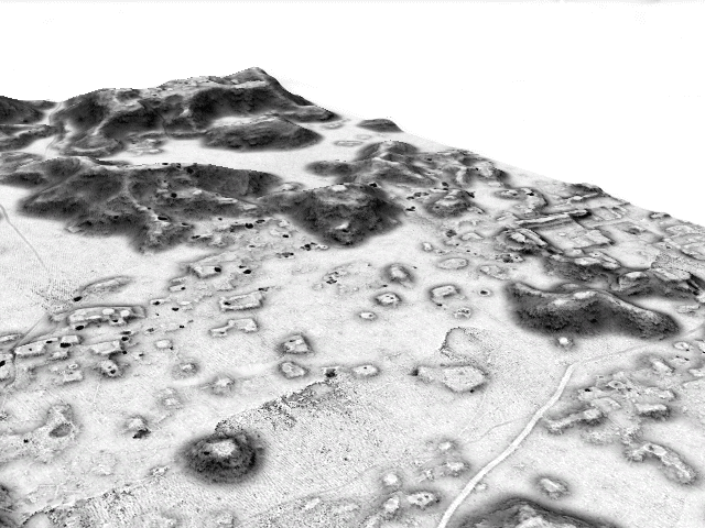
Processed G-LiHT LiDAR data where a sky view factor was draped on a digital terrain model (DTM), resulting in a 3D visualization of the ancient Mayan cultural landscape of Kiuic (Yucatán) in Mexico.
Case study in Kiuic
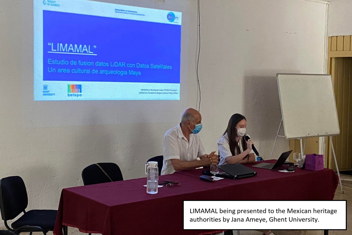
At a conference held in Mérida, Mexico, in March 2022, the results of the LIMAMAL project were presented to authorities and archaeologists from the National Institute of Anthropology and History of Yucatán (INAH-Yucatán). The team presented them with elevation models and 3D visualisations of a Maya city called Kiuic, located in the heart of the Puuc region of the Yucatán peninsula. The workshop participants, who were not experts in remote sensing, were very interested in the guidelines, but also in the data and methods used.
 |
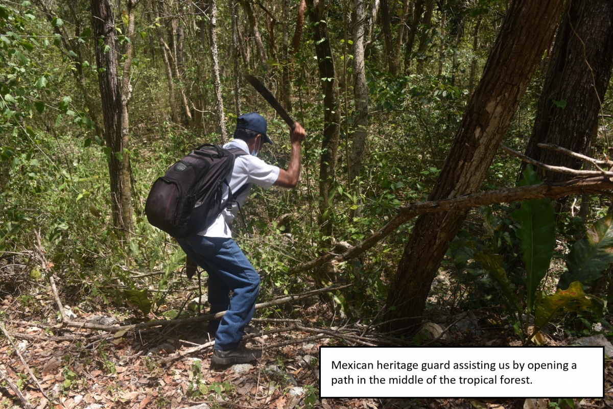 |
The director of INAH also gave permission for the team to visit the Kiuic site for fieldwork. In order to discover the terrain in the oldfashioned way, a pathhad to be cleared through the vegetation with a machete. The team photographed various archaeological remains in order to cross-reference them with the Kiuic ruins and their location on LiDAR visualisations and satellite data. This field visit confirmed that the geometric shapes observed in the remote sensing data indicated the presence of archaeological remains.
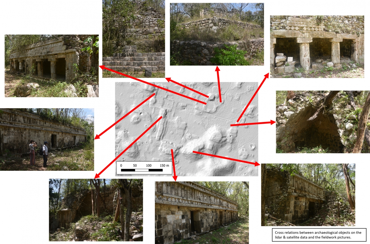
The project was thus able to confirm that the combination of two remote sensing technologies can bring a Mayan site back to life and provide important assistance to archaeologists to better understand the cultural landscape and facilitate the planning of their fieldwork.
More information
![]() Pléiades4Belgium: the Belgian Science Policy portal that gives Belgian institutions access to Pléiades images at very advantageous conditions (free access to all data already acquired by an institution and very competitive prices for new acquisitions).
Pléiades4Belgium: the Belgian Science Policy portal that gives Belgian institutions access to Pléiades images at very advantageous conditions (free access to all data already acquired by an institution and very competitive prices for new acquisitions).
Research on LiDAR data assessment for Mesoamerican archeological landscapes - LIMAMAL