In view of promoting the use of satellite images and particularly images produced by a new generation of satellites equipped with very high resolution sensors (from 4 to 1m) aboard, the Belgian Science Policy Office published in 2000 the poster 'Belgian cities seen from space' .
This poster, produced by the University of Liège shows images of Brussels, Liège and Ghent at a resolution of 1 m. They have been reproduced in natural colours and were obtained from Ikonos images. The poster was part of the 'City promotion' project, a website designed to promote these three cities by means of satellite imagery.
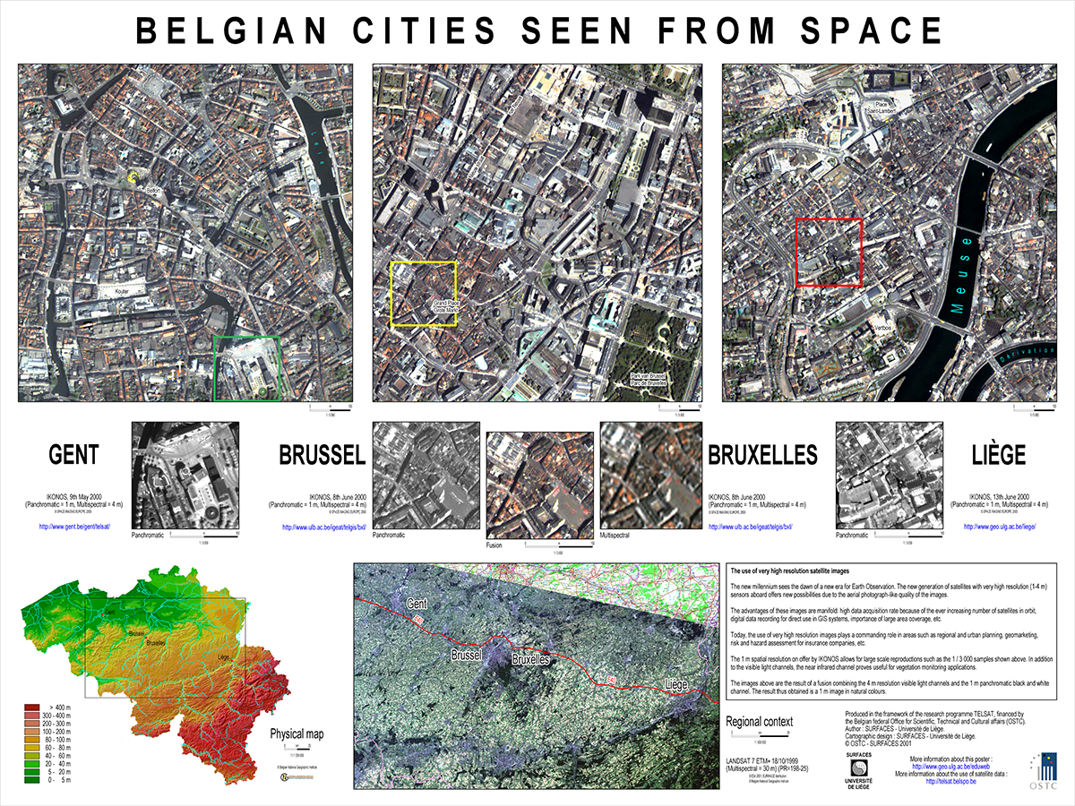
The use of very high resolution satellite images
The new millennium saw the dawn of a new era for satellite Earth observation. A new generation of satellites with very high resolution (1-4 m) sensors aboard offered new possibilities due to the aerial photograph-like quality of the images.
The advantages of satellite images are manifold: high data acquisition rate because of the ever increasing number of satellites in orbit, digital data recording for direct use in GIS systems, importance of large area coverage, …
The use of very high resolution images plays a commanding role in areas such as regional and urban planning, geomarketing, risk and hazard assessment for insurance companies,…
The 1 m spatial resolution offered by Ikonos allowed for large scale reproductions such as the 1 / 3 000 samples shown above. In addition to the visible light channels, the near infrared channel proves useful for vegetation monitoring applications.
The images above are the result of a fusion combining the 4 m resolution visible light channels and the 1 m panchromatic black and white channel. The result thus obtained is a 1 m image in natural colours.