Published on 16 August 2021
Magnitude 7 earthquakes are at the higher range on the Richter scale, and indicate a major earthquake that is expected to cause serious damage.
The earthquake's epicenter was approximately 12 km northeast of Saint-Louis-du-Sud in the southwest of Haiti. USGS reported several magnitude 5 aftershocks in the hours that followed.
Almost 14,000 homes have been reported destroyed with a similar number of homes damaged. Some roads have also been blocked, delaying or preventing supplies from reaching affected some of the affected areas. Hospitals are beyond capacity, with some suffering damage from the earthquake.
International aid has ben dispatched with supplies and personnel to help with disaster recovery.
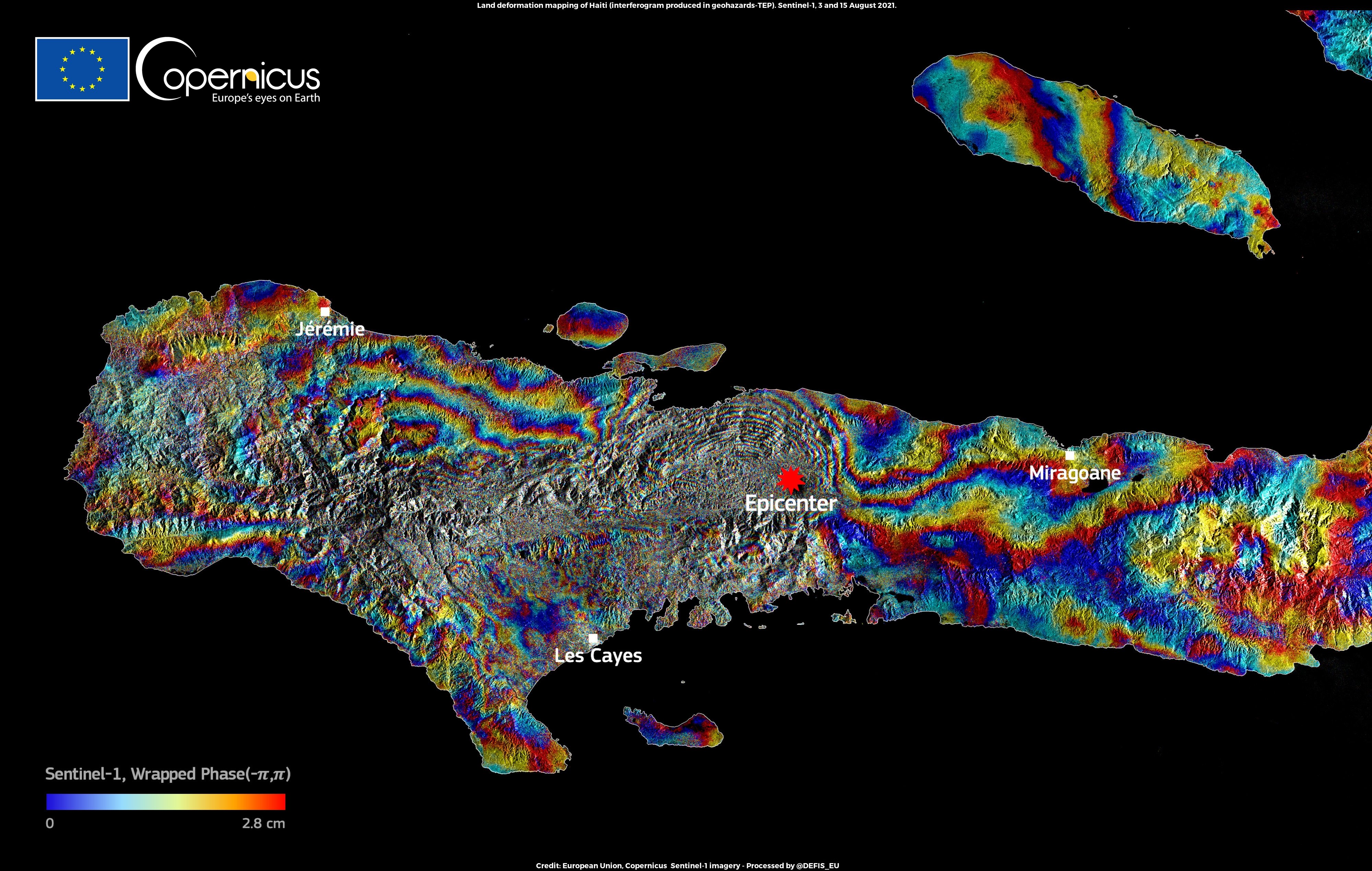 Land deformation interferogram generated using radar data from the Copernicus satellite Sentinel-1 taken on 3 and 15 August. Processed at INGV GeoSAR Lab.
The image above is the first interferogram of the M 7.2 Haiti earthquake. Colours indicate differences between the two dates. A main displacement feature in the center is followed by a second pattern, westward, less intense. The image shows patterns of complex rupture and hard unwrapping.
Satellite data are an essential tool in disaster response, especially in search and rescue efforts directly after the disaster. In order to allow first responders, relief and humanitarian organisations access to these data as soon as possible, the International Charter "Space and Major Disasters" (Disaster Charter in short) was set up. It was activated for this earthquake shortly after the disaster, and since then a whole slew of Pléiades, Worldview and Sentinel data have already been made available.
 The disaster Charter Geobrowsing Tool offers an easy way to navigate the available images
But the ordeal is not over yet. Tropical Storm Grace is expected to pass Haiti on 16 and 17 August, and is forecast to bring strong wind and heavy rain to the coast of the country, potentially adding floods and mudslides to the disaster.
See also
Earthquake and Tropical storm in Haiti - CNES activates Pléiades satellites in aid of relief efforts