Published on 10 January 2023
Within the Horizon 2020 RapidAI4EO project VITO Remote Sensing therefore developed advanced land cover classification and change detection algorithms to identify hotspots of change and produce monthly land cover maps over these hotspots. Wanda De Keersmaecker explains more about rapid and continuous land monitoring to better measure and understand the human footprint on our planet, a key challenge of the UN Sustainable Development Goals.
Deep learning for unsupervised land cover change detection
Intensified monitoring of land cover and land use is crucial to improve studies of forest loss dynamics and drivers, but also support policies related to agriculture, climate change mitigation, urbanization or biodiversity. RapidAI4EO brought together industry leaders including Planet, Vision Impulse, IIASA and Serco Italia to advance the state-of-the-art in Land Use Land Cover Classification and Change Detection from remote sensing observations. Within this project, VITO was responsible to develop (i) an unsupervised change detection algorithm based on Deep Learning that allows to identify hotspots of change and (ii) a land cover classification workflow to produce monthly land cover maps over these hotspots. These algorithms were developed using high resolution (i.e. 3 m Planet Fusion and 10 m Sentinel-2 data) and high cadence data (i.e. monthly updates).
One of the challenges that we faced when detecting changes using monthly satellite time series is that satellite images can present a lot of variation from one acquisition to another. For instance, phenological change - following the seasonality of vegetation - is present throughout the year, while altered meteorological conditions can lead to interannual change of the vegetation condition. All these changes cause a significant variation in the raw pixel values, yet they are not land cover changes.
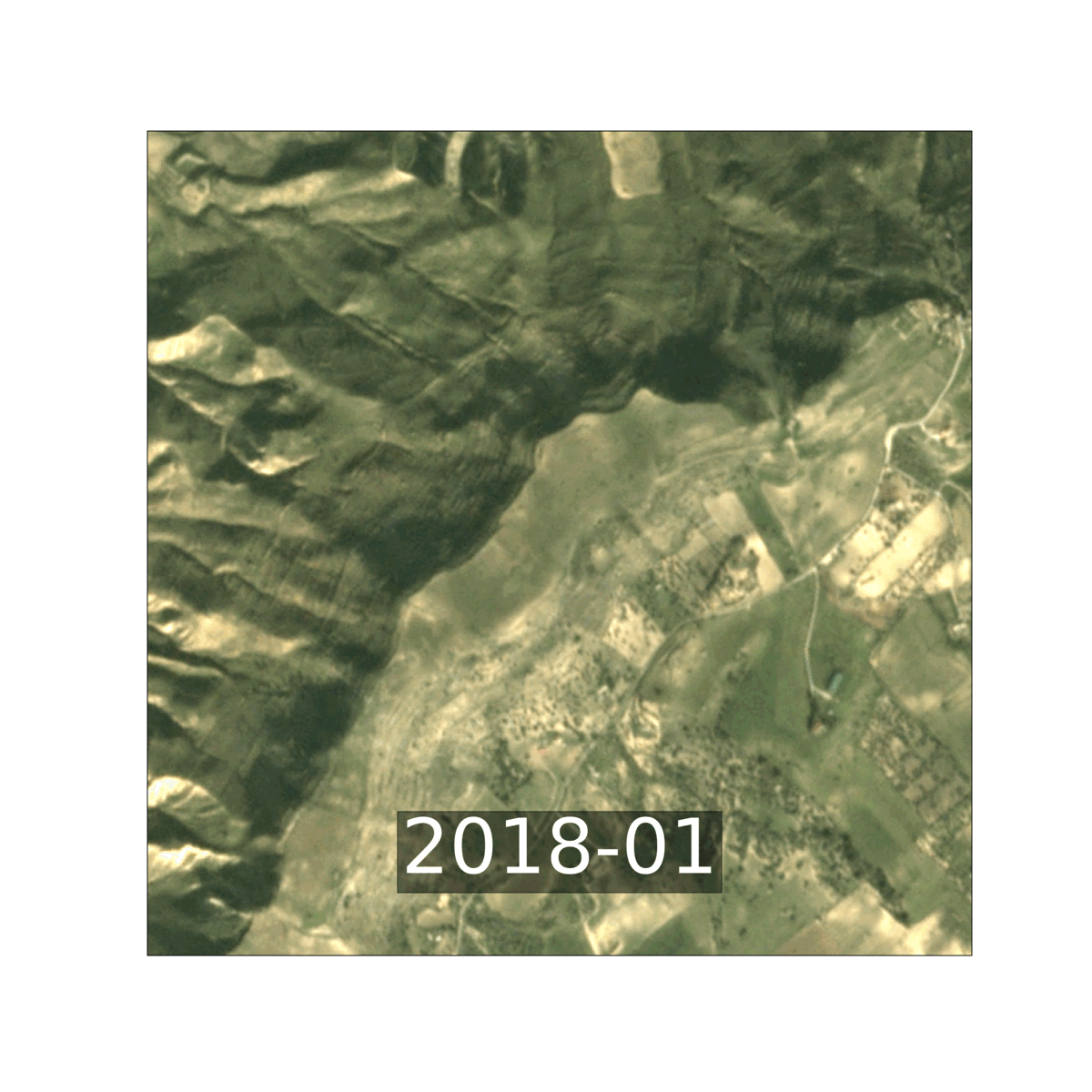
Example of phenological change in a time series of Planet Fusion imagery of Sicily
This mixture of various change types can introduce irregular temporal dynamics of unchanged pixels and hence complicates the detection of real land cover change based on single pixel time series. The use of a long time span and the evaluation of contextual information present in the images may help to achieve a more reliable identification of land cover changes. Deep Neural Networks can for instance learn complex features from the images and encode the relevant (contextual) information into a mono-dimensional compressed vector which is easier to handle than the original images.
Seasonal versus structural changes
To this end, we developed an unsupervised change detection algorithm based on deep learning architectures to extract feature representations of image patches. The algorithm aims to identify areas whose land cover changed over time, and for which a land cover update at pixel level is thus needed.
We used the concept of triplet loss to extract compressed image features. We built upon the Tile2Vec algorithm that has originally been developed for learning compressed representations from unlabelled remote sensing data to classify images. Here, we adjusted the algorithm to ensure the separation of seasonal and structural information and hence facilitate the detection of land cover changes. We trained the algorithm on a set of 500 000 image Sentinel-2 and Planet Fusion image patches, where we explicitly rewarded the algorithm to minimize seasonal effects on the vector representation, while maximizing the distance between the vector representations due to a change in land cover.
Source:
VITO Remote Sensing. (2023, January 3). Towards continuous land cover mapping at high resolution. Retrieved January 10, 2023