Context and objectives
Knowledge of the spatial distribution and dynamics of soil moisture is essential for optimal and sustainable management of soil and water resources as it governs all important key processes of the hydrological cycle such as infiltration, runoff, root water uptake, evaporation, as well as energy exchanges with the atmosphere. Synthetic aperture radar (SAR) remote sensing in particular provides soil moisture information from the field to the catchment and larger scales. Yet, soil moisture products derived from remote sensing still suffer from large uncertainties due to the relatively poor relevance of traditional soil sampling for calibrating and validating SAR processing algorithms. In that respect, the latest ground-penetrating radar (GPR) developments (UCL) permit now to accurately and rapidly map soil moisture at the field scale and thereby circumvent major limitations related to the inherent field-scale variability. In that context, the general objective of the SENSAR project is to improve remote sensing of soil moisture by SAR using advanced GPR technology for providing relevant ground-truthing to properly calibrate and validate SAR inversion algorithms.
Project outcome
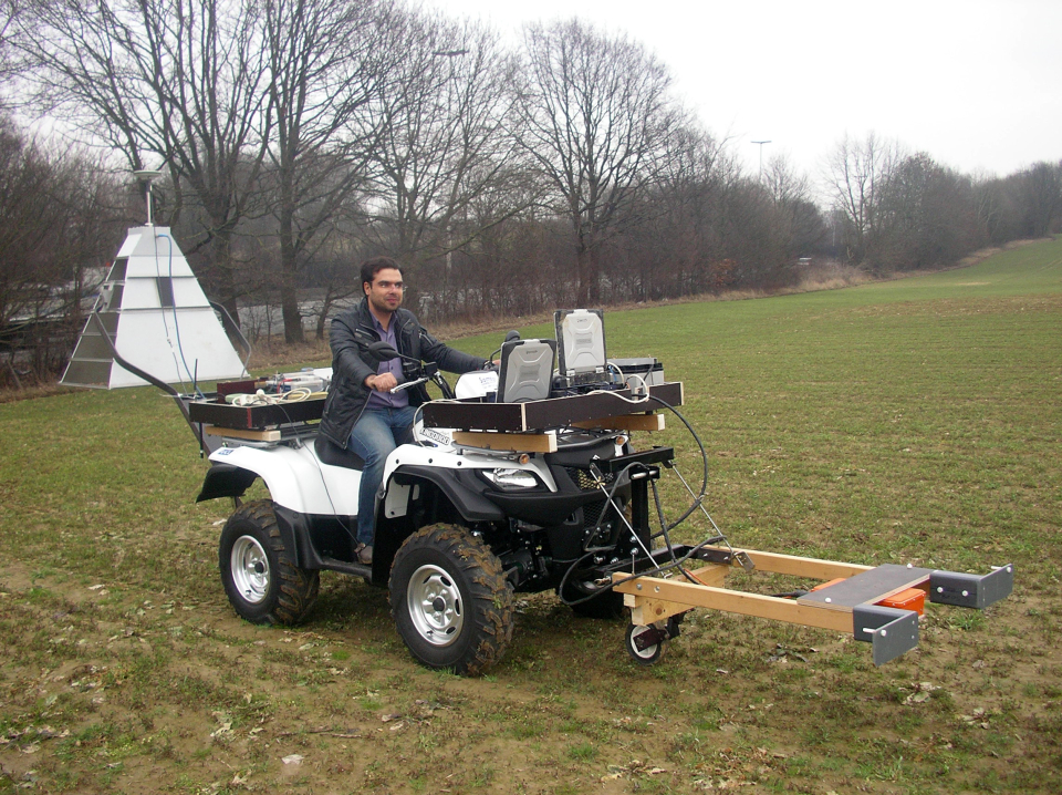
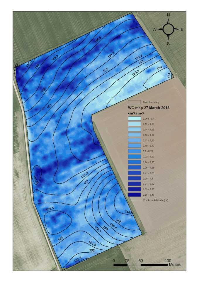
- A new GPR platform was designed to provide high-resolution maps of soil moisture at the field scale. Measurements and analyses in near-field conditions for a higher signal-to-noise ratio and smaller GPR antenna footprint for a better comparison with traditional soil sampling;
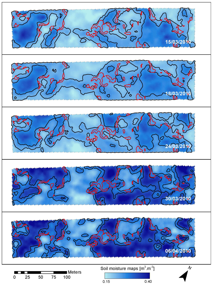
- The resulted soil moisture maps showed a high degree of consistency;
- The usefulness (and necessity) was demonstrated of high-resolution characterization of soil moisture at the field scale using advanced GPR to improve both the spatial resolution and especially quality of the SAR-derived soil moisture;
- The vegetation cover strongly affects microwave remote sensing backscattered signals and makes difficulties in retrieving the surface soil moisture. A new effective vegetation cover model was developed for full-wave inversion of GPR data assuming multiple layers with effective electrical properties. Applying this model to the GPR full-wave inversion led to a significant correction on GPR derived soil moisture values from the field measurements.
- A new SAR data processing technique was introduced that takes advantage of the non-time consuming nature of SAR measurements, but without needing to reduce the spatial resolution to filter for speckle. The model developed uses the high-resolution knowledge of these patterns with new SAR data to estimate the surface soil moisture. Three SAR data processing were in particular compared, namely, (1) the classical multilook model, (2) the moisture difference landscape model, and (3) the backscatter difference landscape model. Both new models (2-3) show promising initial results, despite the far from ideal conditions of the measurement campaigns.
| Project leader(s): | UCL - Environmental Sciences | |||
| Belgian partner(s) |
|
|||
| Location: | ||||
| Related presentations: | ||||
| Related publications: | ||||
| Website: | http://rch2011.adre.ucl.ac.be/browse/list_fac/ELIE/pending/10044255 | |||