Context and objectives
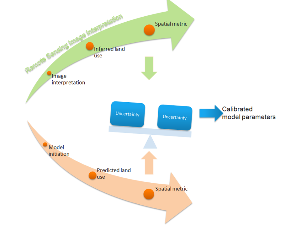
Urban change processes are increasingly affecting the environment. They stress the need for more effective urban management approaches based on the notion of sustainable urban development. The problem analysis, planning and monitoring phases of sustainable urban management policies require reliable and sufficiently detailed information on the urban environment and its dynamics. Geospatial and socio-economic data supplemented with knowledge on dynamic urban processes are incorporated in the land-use change models currently available to planners and policy makers. They enable them to assess the impacts of decisions on the spatial systems that they are to manage. To be usefully applicable to this effect, land-use change models need extensive calibration. Current calibration methods, however, do not take into account uncertainties in the parameterization of these models and in land-use data used as a reference. This leads to uncertainties in the prediction of future land use, which need to be quantified and reduced. This project aims to provide a solution to this issue by applying a data assimilation framework to the calibration of land-use change models. The framework will use land-use maps and remote sensing derived land-use data at time steps that they are available in order to optimize the parameters of the land-use change model.
Project outcome
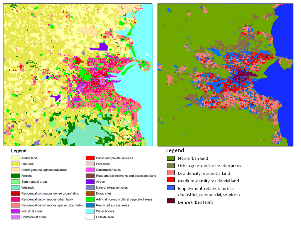
- Reference land-use maps obtained from Landsat and SPOT images through (i) sub-pixel estimation of sealed surface cover for each urban pixel and (ii) application of a multiple layer perceptron (MLP) approach to infer urban land use from urban form, based on the spatial arrangement of sealed surface cover fractions at street block level.
- Definition of method to quantify and model uncertainties in the remote sensing land-use interpretation chain;
- Identification of sources of uncertainty in this land-use interpretation chain;
- Assessment of impact of uncertainties in remote sensing image interpretation on the urban land-use patterns derived from the data and quantified by way of spatial metrics. Uncertainty proves to be highest in zones with a mix of residential and employment land uses. The most profound impact is generated when the classification uncertainty and the impervious surface estimation uncertainty are combined, resulting in higher uncertainties overall;
- A probabilistic calibration scheme based on data assimilation using a particle filter to tackle the calibration problem in the MOLAND Cellular Automata land use change model applications and which performs equally well at urban as at regional level and reduces the uncertainties in the simulation results and model predictions;
- Automatically calibrated models for Dublin and Flanders.
| Project leader(s): | UNESCO-IHE | |||
| Belgian partner(s) |
|
|||
| International partner(s) |
|
|||
| Location: | ||||
| Related presentations: | ||||
| Related publications: | ||||
| Website: | http://www.asimud.be | |||