Published on 16 September 2021
The Dixie megablaze, the largest wildfire of the 2021 fire season and the second-largest blaze in recorded state history, has burned more than 388 000 hectares of mainly forested land and has destroyed more than 1200 buildings on its path. The fire, named after the road where is started, began on 13 July in the Feather River Canyon, and as of 14 September, is only 75% contained.
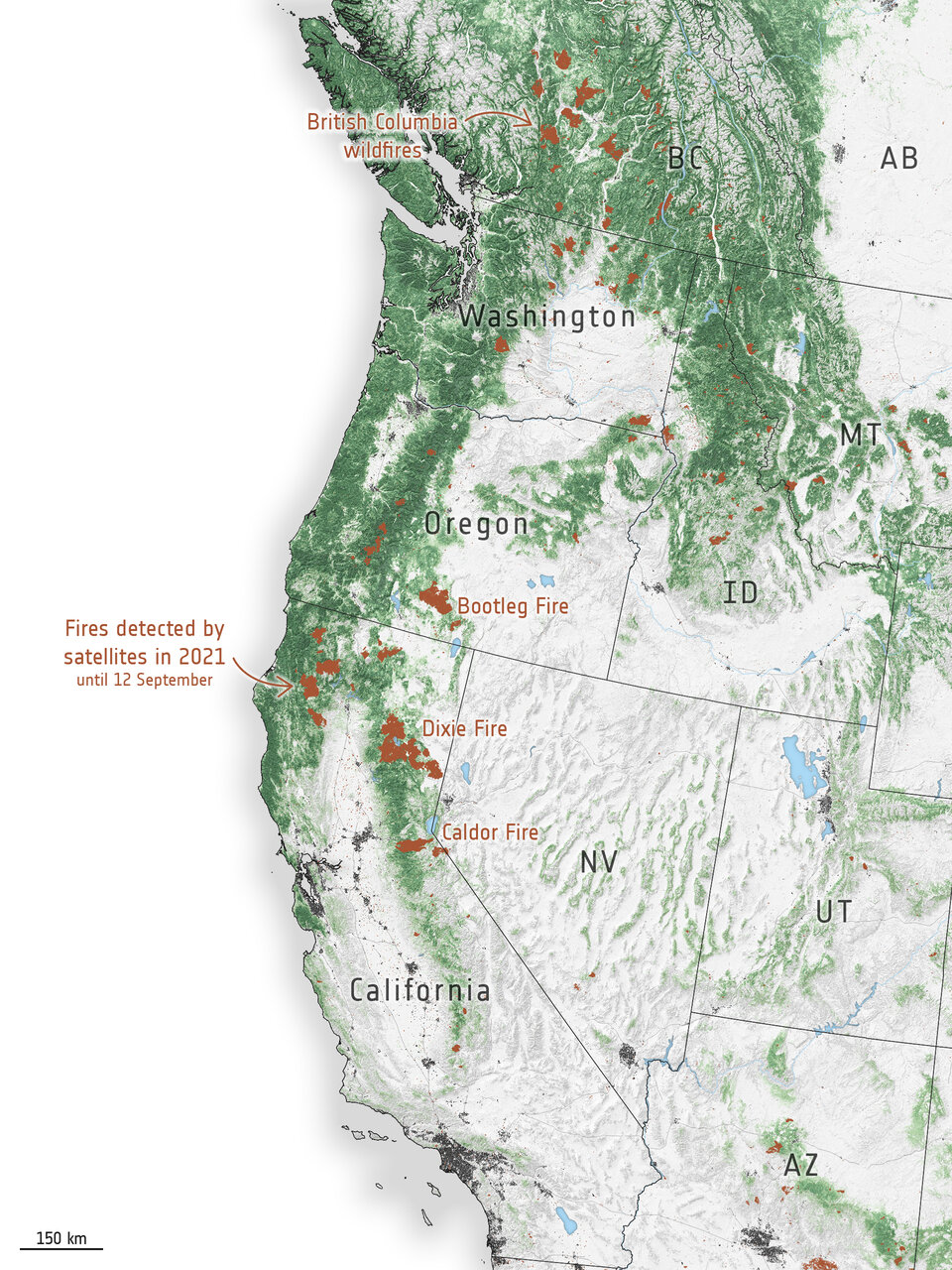
Fire hotspots along the US West Coast
With thousands of firefighters continuing to battle the blaze, several were diverted to help harness the nearby Caldor Fire which has burned more than 88 700 hectares, threatening communities near Lake Tahoe before crossing the state’s border over to Nevada.
The map on the left shows wildfire hotspots along the US West Coast in 2021. Further north, a number of Canadian Provinces, including British Columbia, have also been experiencing intense fires since the end of June.
The Copernicus Sentinel-2 mission has been used to image the fires. The Sentinel-2 satellites each carry just one instrument – a high-resolution multispectral imager with 13 spectral bands. Captured on 1 September, the smoke and burn scars of the Caldor and Dixie Fires are visible in this image.
According to the Copernicus Atmosphere Monitoring Service (CAMS), smoke from the fires in North America has been transported across the continent and out over the Atlantic Ocean towards Europe yet is unlikely to affect Europeans as it is high up in the atmosphere. The smoke has, however, impacted air quality across the US and Canada, where it was much closer to the surface.
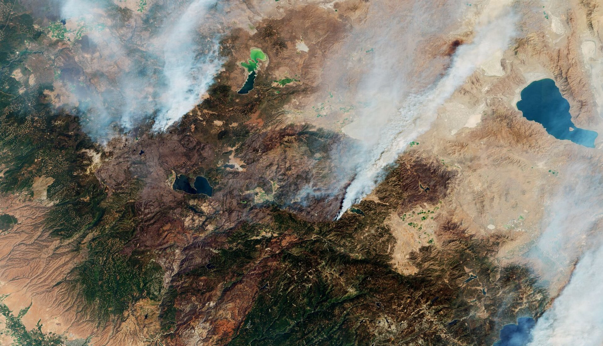 California fires captured by the Copernicus Sentinel-2 mission
The Copernicus Sentinel-5P satellite is dedicated to monitoring air pollution by measuring a multitude of trace gases that affect the air we breathe. Images captured on 30 August show the presence of aerosols in the atmosphere caused by the fires. The plumes continued their journey eastwards, across the US even reaching Europe.