Published on 11 March 2022
The states of Queensland and New South Wales in Australia have been experiencing prolonged rainfall that has caused a historical flooding event with catastrophic consequences. In Sydney, the capital of New South Wales and Australia’s most populous city, more than a year’s worth of rainfall poured down within a week, destroying property and sweeping away roads and livestock. To date, the death toll caused by the flood has risen to 20, while tens of thousands of people have been forced to evacuate their homes.
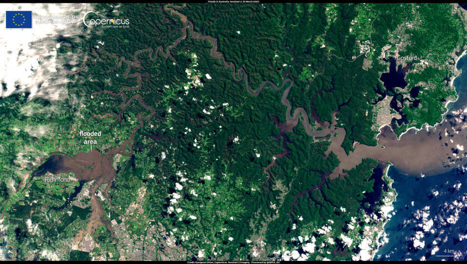
The flooded area north of Sydney is visible on this image, acquired by one of the Copernicus Sentinel-2 satellites on 10 March 2022. The Copernicus Emergency Management Service (EMS) delivers Rapid Mapping products, providing geospatial information within hours or days of a service request, in order to support emergency management activities in the immediate aftermath of a disaster. An activation on Copernicus EMS for the floods in Queensland has been ongoing since late February.