Published on 22 February 2023
Coastal erosion is rapidly changing the French coastline, particularly in areas along the coast of the Atlantic Ocean.
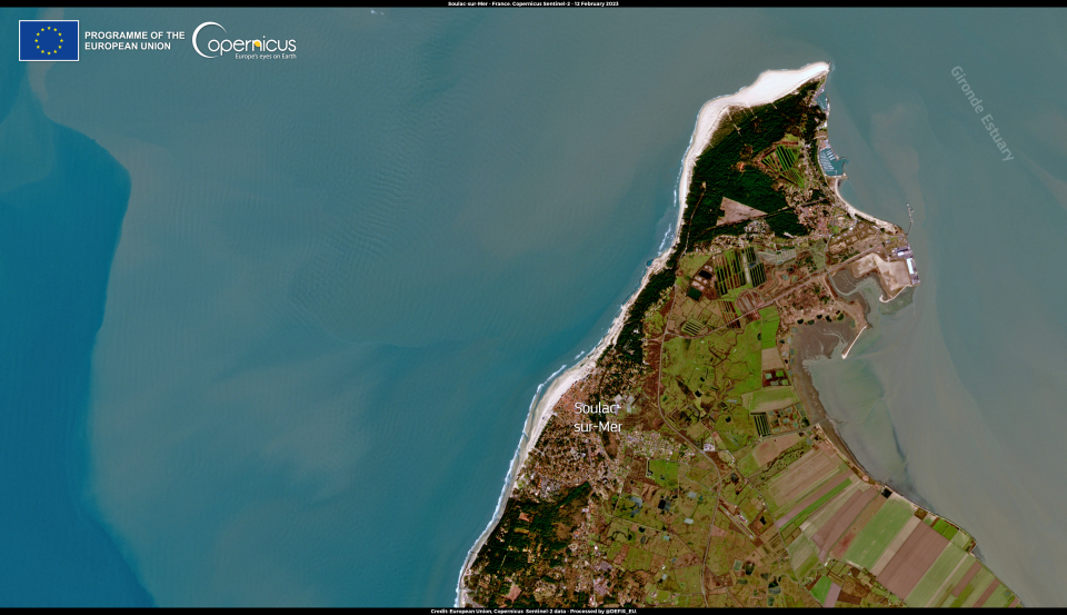
The image below, acquired by one of the Copernicus Sentinel-2 satellites on 12 February, shows the area of Soulac-sur-Mer, located at the northernmost tip of the Gironde estuary. In this area, beaches are receding at a rate of 2.5 meters per year due to rising sea levels. Recently, an apartment block that symbolised the touristic vocation of the town has been demolished due to its precarious location on a dune just meters from the water.

The Copernicus Land Monitoring Service product portfolio includes a Coastal Zones product, which has been developed to allow the monitoring of the complex dynamics of coastal environments and to support actions to mitigate the effects of climate change, and in particular, sea level rise.
Source:
Coastal Erosion poses a threat to the Atlantic coasts of France. (2023, February 21). Copernicus Image of the Day.