Published on 13 May 2019
In early May 2019, Tropical Cyclone Fani tore through the state of Odisha in eastern India as one of the worst storms to hit the country since 1999. The storm caused 64 deaths and left millions of people homeless in the cities of Puri, Bhubaneswar, Cuttack, and Khurda. Fani also damaged or destroyed energy infrastructure and many buildings, leaving around 3.5 million households without electric power for days after the storm hit.
As Tropical Cyclone Fani bore down on the eastern coast of India, the storm gained significant strength over the past 24 hours.
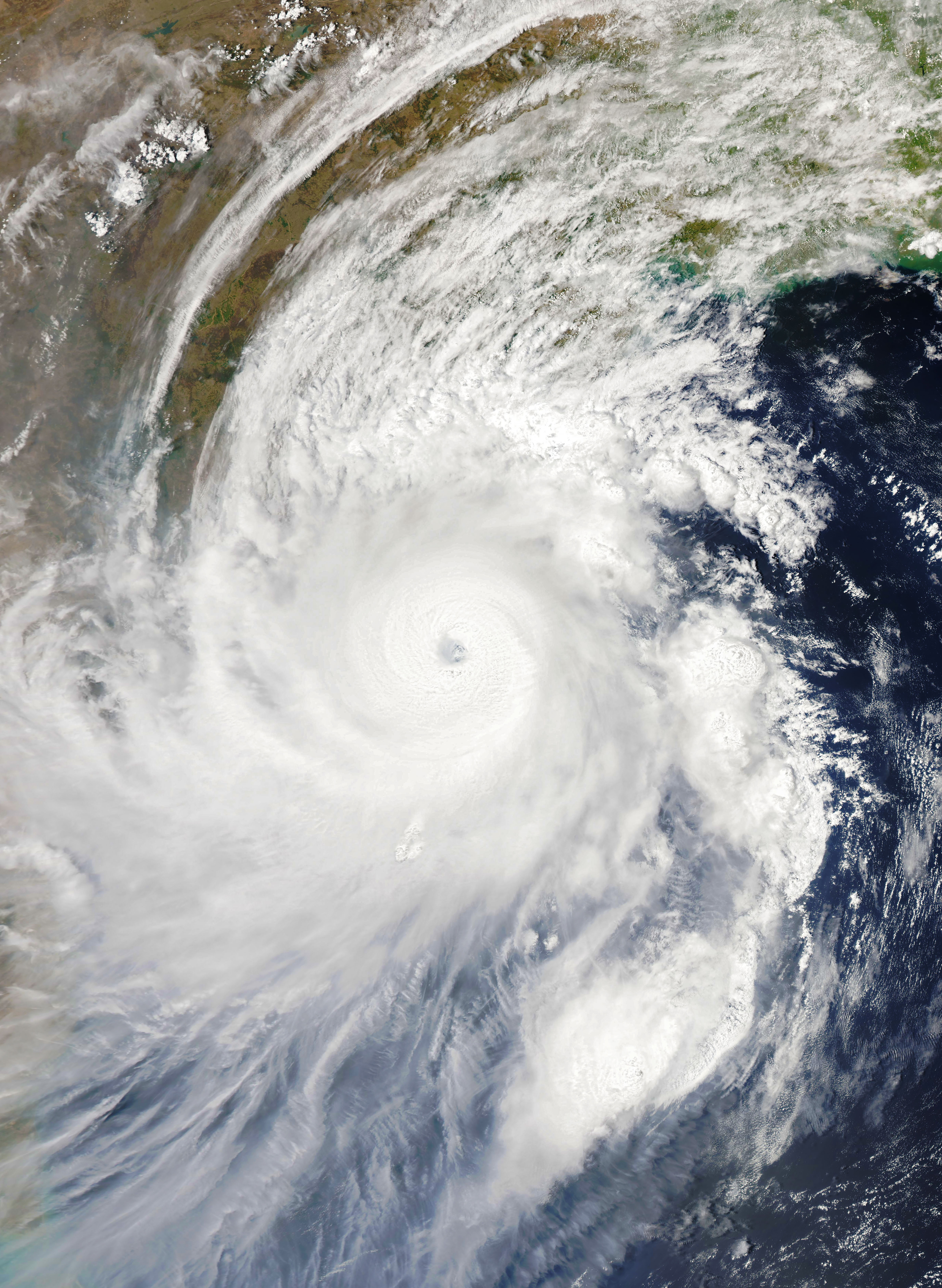
The Moderate Resolution Imaging Spectroradiometer (MODIS) on NASA’s Aqua satellite acquired this natural-color image at 1:02 p.m. India Standard Time on May 2, 2019. Around that time, the storm had sustained winds of 250 kilometers per hour. That’s the equivalent of a severe category 4 storm on the Saffir-Simpson wind scale.
According to the U.S. Joint Typhoon Warning Center, the intensification happened as Fani became more organized and developed a 30-kilometer-wide symmetrical eye.
Warm sea surface temperatures (between 30-31 degrees Celsius) along with warm, humid air provided fuel for the storm.
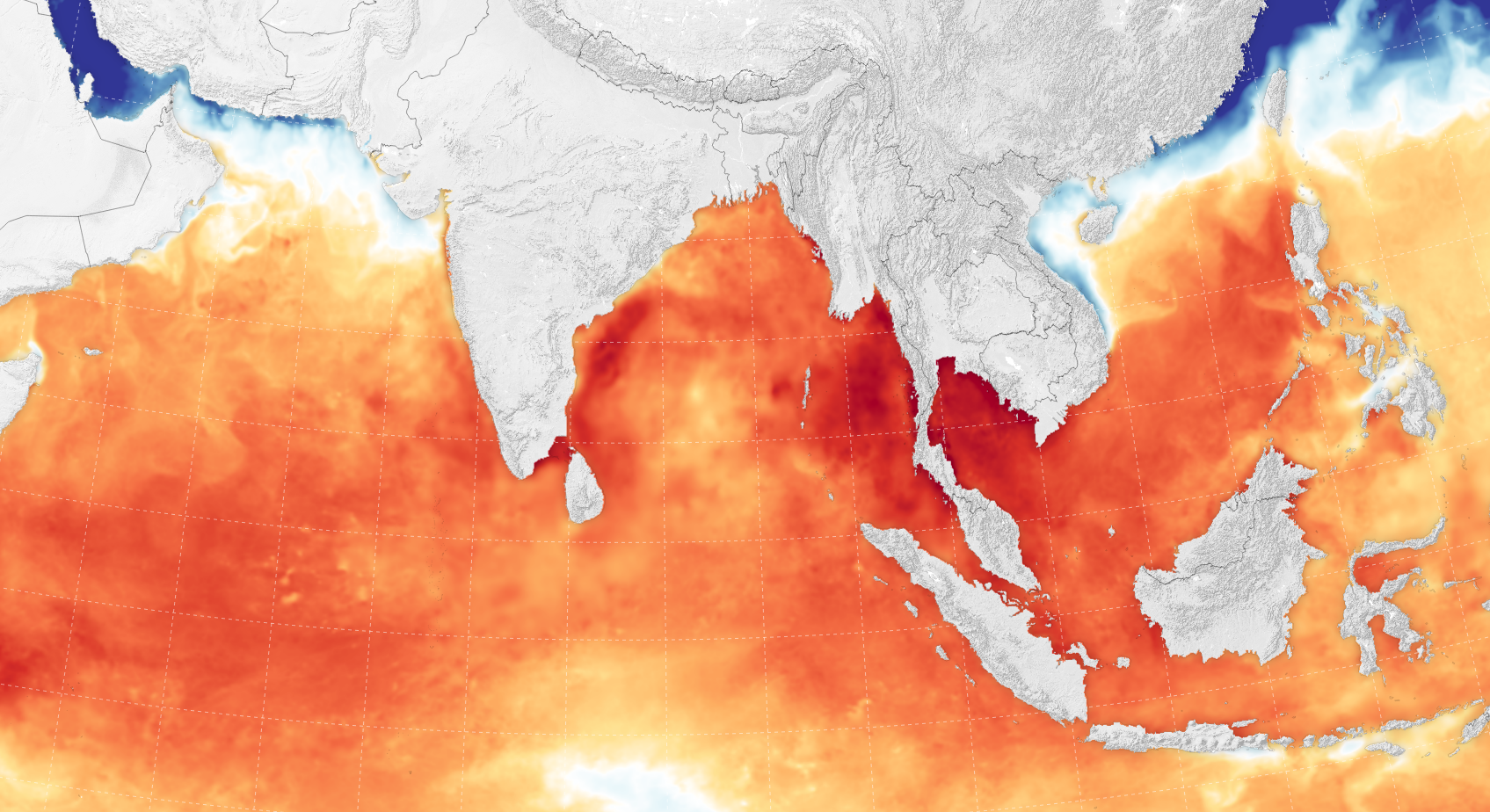
The map above shows sea surface temperatures on May 1, 2019. Meanwhile, the difference in lower level and upper level wind speeds (or sheer)—which can sometimes rip storms apart—was small enough to allow this storm to build. Hundreds of thousands of people have been ordered to evacuate ahead of Fani’s landfall.
Learn more: