Published 5 days ago
Satellite measurements show that the 2026 El Niño is developing into one of the strongest events observed during the modern altimetry era. Sea levels across the central and eastern Pacific now show striking similarities to those measured during the powerful 1997–98 event.
El Niño develops when warm surface water shifts eastwards across the equatorial Pacific. Because warm water expands, satellite altimeters can track this movement through changes in sea surface height, providing a basin-wide view of how an event evolves.
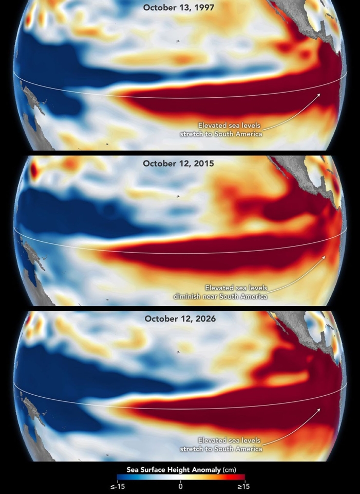
Satellite altimetry reveals how the Pacific sea-level patterns of the major El Niño events of 1997–98, 2015–16 and 2026 compare, highlighting both striking similarities and important differences.
Image: NASA Earth Observatory/Lauren Dauphin, using altimetry data provided by NASA/JPL-Caltech
Comparing these events is possible thanks to more than three decades of continuous satellite altimetry. The record began with missions such as TOPEX/Poseidon and the Jason series and is now continued by Copernicus Sentinel-6, operated by EUMETSAT as part of an international partnership involving the European Union, ESA, NASA, NOAA and CNES.
Sentinel-6 provides the reference measurements that maintain the long-term global sea-level record, while EUMETSAT also operates Sentinel-3 and Jason-3 and distributes their ocean-altimetry data. These sustained observations are essential for monitoring large-scale ocean phenomena such as El Niño and understanding their role in weather and climate.
Although the 2026 event resembles 1997–98 in several respects, no two El Niño events are identical. Differences in the atmosphere and ocean mean their impacts on rainfall, drought and weather patterns can vary considerably.
Based on: NASA Earth Observatory, El Niño Then and Now, 23 October 2026.