Published on 1 July 2021
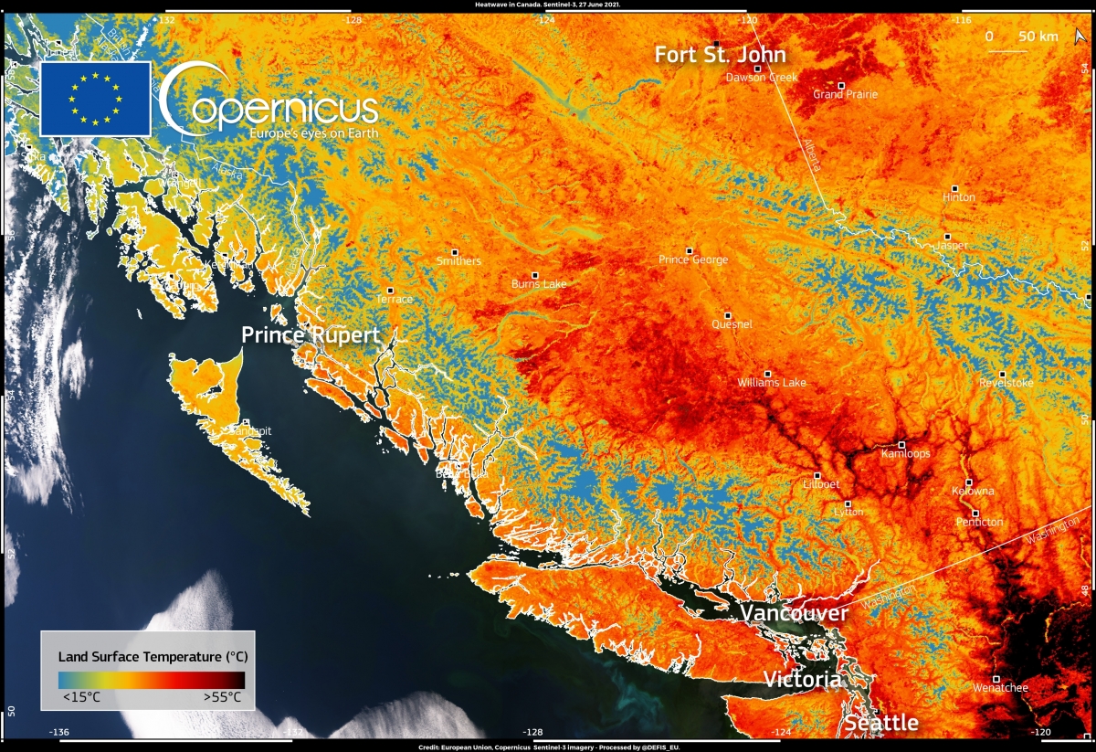
This image, acquired by one of the Copernicus Sentinel-3 satellites on 27 June 2021, shows the land surface temperature in British Columbia in Canada and parts of Washington state in the United States.
This area of the American continent is experiencing a record heat wave.
In Lytton (British Columbia), the temperature rose to 46.6°C on 27 June and to 47°C on 28 June, breaking an 84-year-old record.
Credit: European Union, Copernicus Sentinel-3 imagery. Source: Copernicus Image of the day
As this image shows, at 11:53 local time of the 27 June, the land surface temperature (i.e. the temperature of the soil, not to be confused with the temperature of the air at ground level) in the lowlands was above 45 °C in many areas, with peaks of 56°C near Kamloops (located 100 km northeast of Lytton) and 63°C in Wenatchee in the United States.
The Copernicus Sentinel-3 mission can measure both sea and land surface temperatures (SST, LST). Both measurements contribute to the estimation of climatological indicators to monitor the impacts of climate change around the world.
More information
US-Canada heatwave: Visual guide to the causes (BBC News)
Exceptional Heat Hits Pacific Northwest (NASA Earth Observatory)