Published on 9 June 2022
The early years
The history of Copernicus traces its roots to Baveno, a small town in the northwest of Italy. There, on 19 May 1998, the representatives of the European Commission, of Europe’s space agencies, EUMETSAT and ESA signed the Baveno Manifesto. This document contained a proposal for the creation of a monitoring programme and called for a long-term commitment that would position Europe as a leader in handling global environmental and climate issues.
This newly born programme was named GMES, “Global Monitoring for Environmental Security”. However, one year after the signature of the Baveno Manifesto, the meaning of the acronym was changed to “Global Monitoring for Environment and Security”, to reflect the profound security implications of environmental monitoring and management. This central role was further emphasised in 2002 when “Security”, within the scope of the GMES programme, was defined to include the prevention of and the response to risks of both natural and technological nature, peacekeeping tasks and conflict prevention, rescue tasks and humanitarian aid, as well as the surveillance of European borders.
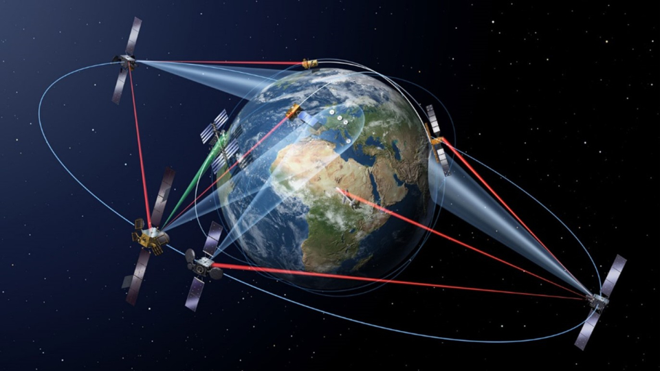
The satellites of the Copernicus constellation we are familiar with today have their origin back in 2004 when a space-based observation component was proposed. The resulting agreement signed between the European Commission and ESA set the stage for the Sentinel family of satellites which, still today, makes up the pulsating heart of the EU’s own Earth Observation system. Developed, produced, and launched by ESA on behalf of the European Commission, the Sentinels have been, since the beginning, one of Copernicus’ key ground-breaking aspects and, thanks to their state-of-the-art technology and design, have played a pivotal role in positioning Europe as a world leader in Earth Observation.

A graphical rendition of the Sentinel family of satellites orbiting Earth (Source: ESA)
The following year saw the publication of the European Commission Communication “GMES: From Concept to Reality”, which established the priority for the initial GMES services roll-out. In particular, the attention focused on both land and marine monitoring, as well as emergency response. 2005 also saw GMES becoming Europe’s main contribution to GEOSS, the Global Earth Observation System of Systems, thus establishing its role as one of the most prominent Earth monitoring systems in the world.
From GMES to Copernicus
In 2011 the GMES Initial Operations phase began, which were set up as an interim instrument to bridge the pre-operational services of GMES and the full exploitation of the programme which, the following year, was finally renamed. The name of Copernicus was chosen to replace GMES, as an homage to Polish astronomer Nicolaus Copernicus and his theory at the basis of heliocentric solar system model which “[…] opened man to an infinite universe, previously limited by the rotation of the planets and the sun around the Earth and created an understanding of a world without borders”.
2012 saw the start of operations for the first two Copernicus services, the Copernicus Land Monitoring Service (CLMS) and the Copernicus Emergency Management Service (CEMS), with the latter being declared the first fully operational one within the Initial Operations phase.
The full, free, and open access to the data policy, one of the foundational pillars of Copernicus, was introduced the following year. This policy ensures that a free-of-charge database from Copernicus is always accessible, without limitation on time, for both European and non-European users, regardless of the target use (commercial or non-commercial), and it has enabled countless applications relying on Copernicus to be developed.
One of the most important dates for Copernicus is 3 April 2014. On this day, the Space Component of Copernicus officially saw the light of day: launched from the Guyana Space Centre in Kourou, Sentinel-1A was the first Copernicus satellite to reach orbit. It is a radar satellite providing day and night imagery for CEMS, CLMS as well as the Copernicus Marine Environment Monitoring Service (CMEMS), which was launched in 2015 together with the Copernicus Atmosphere Monitoring Service (CAMS).
The second Copernicus satellite, Sentinel-2A, was launched on 23 June 2015, equipped with high-resolution multispectral cameras. Sentinel-3A followed on 16 February 2016, carrying a wide range of optical, radar, and altimetry sensors to serve both CLMS and CMEMS. The same year also saw the completion of the first Sentinel constellation with the launch on 25 April of Sentinel-1B, as well as the beginning of operations of the Copernicus Security Service.
Sentinel 2A was joined in orbit by its twin, Sentinel-2B on 7 March 2017, marking the completion of the second constellation. Another Sentinel satellite, Sentinel-5P (Precursor), was launched in October of the same year, focusing on atmospheric monitoring, and filling the gap until the launch of the dedicated Sentinel-5.
The third constellation was completed on 25 April 2018 with the launch of Sentinel-3B, which brought the revisit time for the global multispectral optical data coverage to only two days. 2018 was also the year of the start of operations of the sixth Copernicus service, the Copernicus Climate Change Service (C3S), and the launch of the Data and Information Access Services, which enable easy access to Copernicus data in the cloud, together with cloud-hosted tools.
In November 2020, Sentinel-6A was the eighth satellite of the Sentinel family to reach orbit. Providing high-accuracy altimetry data, Sentinel-6A is focused primarily on oceanography, sea-level rise and climate studies.

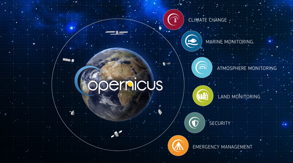
The six services provided by the Copernicus programme through the Sentinel satellites
The future ahead
While the past years have seen numerous launches of the Sentinel family, the coming years are also going to be busy. On the one hand, several launches are planned to complete the current generation of Copernicus Sentinel satellites, with both replacement for older ones (such as Sentinel-1 and Sentinel-2) and new ones being brought to orbit (such as Sentinel-4, Sentinel-5, and Sentinel-6B). On the other hand, expansion missions are being developed within the scope of the second generation of Copernicus. Six High-Priority Candidates are currently in a design phase to complement the existing capabilities of the current constellation and are expected to reach orbit in the form of a new set of Sentinel satellites (from Sentinel-7 to Sentinel-12).
Copernicus has a bright future ahead, with many new users expected to join the millions already benefiting from its services. It will continue to provide support to the scientific community, industry, citizens, and governments in the development of innovative space-based applications and services.