Published on 26 July 2021
After the 2004 Indian Ocean tsunami, Wetlands International saw that many lives had been spared by something surprising – mangroves. In response the non-profit organisation scaled up its work on protecting and restoring these complex ecosystems. One important tool in their arsenal is images from the Copernicus Sentinel-1 and -2 satellites.
Mangroves make up only a small proportion of the world's forest but are vital for humans and nature. They are home to fish, shellfish, birds and mammals. They store more carbon per hectare than rainforests. And they protect coastal communities from extreme weather. As Wetlands International discovered, they can reduce the destructive force of a tsunami by up to 90%.
Lammert is an information manager at Wetlands International. He explains: "After the 2004 tsunami we saw that areas with intact mangroves suffered far fewer deaths and less damage than those with lost or damaged mangroves."
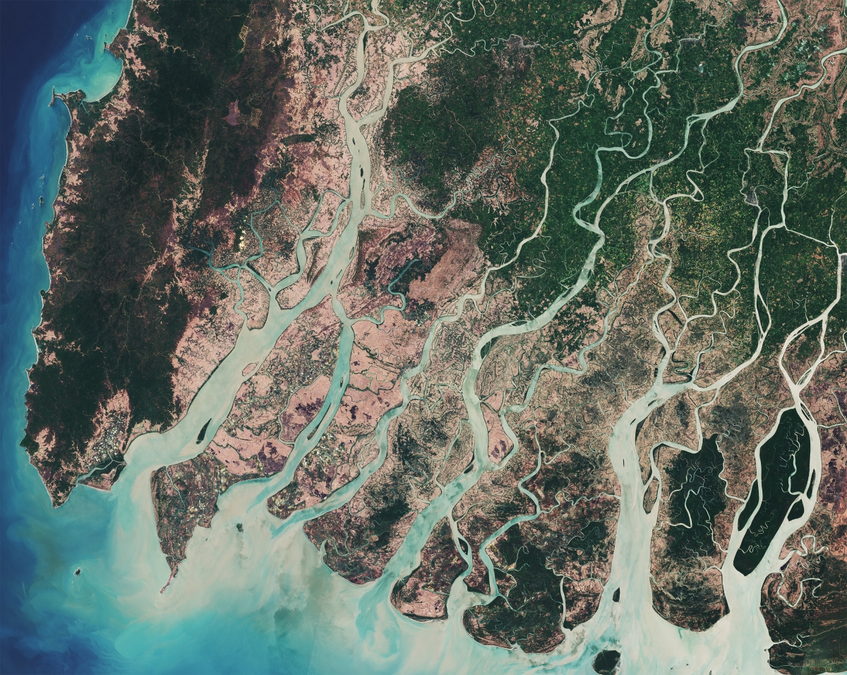
The Irrawaddy Delta in Myanmar, imaged by the Copernicus Sentinel-2A satellite. Green areas show dense mangrove forest. This image combines two acquisitions in March 2017.© contains modified Copernicus Sentinel data (2017), processed by ESA, CC BY-SA 3.0 IGO
Between 1996 and 2016, around 6.6% of mangroves were lost worldwide. This was down from 1% per year in the 1980s.
"Historically, the biggest risk that mangroves face is from conversion to agriculture on the land side, and to aquaculture on the sea side," says Lammert. "But there is also growing pressure from climate change, with rising sea levels starting to overwhelm mangroves and changing rainfall patterns causing some to die off because of a lack of fresh water."
The good news is that most can be restored. An online platform called Global Mangrove Watch is providing remote sensing data and tools for coastal and park managers, conservationists, policymakers and practitioners to respond by pinpointing the causes of local mangrove loss and tracking restoration progress.
See also
MAMAFOREST: Managing mangrove forests from the sky (webstory of the STEREO project Managing Mangrove Forests with Optical and Radar Environmental SaTellites)
The mangroves of Casamance, Senegal (Exhibition Imaging the World's forests)
International Day for the Conservation of the Mangrove Ecosystem (UNESCO)
Six things you can do to bring back mangroves (UN Environment Programme)
Nature’s carbon storehouse (Center for International Forestry Research)