Published 11 hours ago
Months of dry weather have left the Rhine unusually low in 2026. Copernicus Sentinel-2 images now reveal extensive sandbanks along the river near Kaub and Bingen in Germany, where the same areas were still submerged a year earlier.
Water levels at Kaub, an important reference point for Rhine shipping, fell to exceptionally low values after a dry spring and hot summer. Although the gauge reading does not represent the actual depth of the river, low values can significantly restrict how heavily cargo vessels can be loaded.
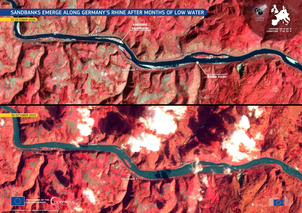
Copernicus Sentinel-2 images compare the Rhine between Kaub and Bingen in October 2026 and October 2025. Large exposed sandbanks are clearly visible in 2026, while the same areas were still covered by water a year earlier.
Image: European Union, Copernicus Sentinel-2 imagery
In the false-colour images, the Rhine appears in dark blue-green tones while surrounding vegetation is highlighted in red. The exposed sandbanks make the effects of the prolonged low-water conditions particularly easy to see from space.
Repeated Sentinel-2 observations help track changes in river extent and exposed riverbeds over time, providing useful information for drought assessment, water management and inland navigation.
Based on: EU Space, Sandbanks emerge along Germany’s Rhine after months of low water, 27 October 2026.