Published on 16 August 2022
Bahrain, a small archipelago in the Persian Gulf, has grown substantially in recent decades. As developers reclaimed land from the sea, the shape of the island nation’s coastline has changed. So, too, has the underwater habitat around it.
The region’s unique land and water features are visible in these satellite images, acquired on July 24, 2022, by the Operational Land Imager-2 (OLI-2) on Landsat 9.
Norman Kuring, a retired researcher from NASA’s ocean biology group, processed the images and used color-filtering techniques to draw out details in the water. He still browses satellite images for anything that catches his eye. “I wasn’t looking for Persian Gulf imagery specifically in this case,” Kuring said. “The region just looked clear that day, and the shallow bottom offered interesting possibilities.”The Persian Gulf averages just 35 meters (115 feet) deep. The water is even shallower close to Bahrain’s shores and reefs—just a few meters deep in places. Sunlight penetrates the shallow water and reflects off submerged surfaces.
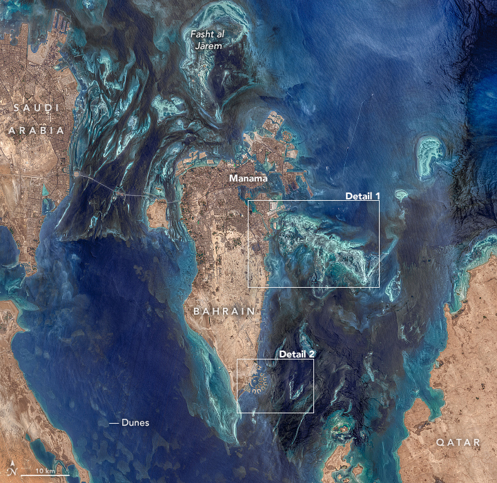
Toward the bottom-left of the image, smooth, dark shapes dot the seafloor. Eman Ghoneim, a physical geographer at the University of North Carolina Wilmington, thinks these are old sand dunes. Thousands of years ago, when sea levels were lower, the dunes were sculpted by wind into crescent shapes. Then rising seas submerged them.
Perhaps most obvious submerged features in the images are the large reefs surrounding Bahrain, visible as the light-green areas offshore. Historically, these structures known as “fasht” were coral or pearl oyster reefs. Today, most of them are dead coral skeletons, although some rocky surfaces still have living corals attached to them, according to Ghoneim, who has studied this underwater habitat with satellites and field surveys.
Read the rest of the article
over on NASA's Earth Observatory website