Published on 18 March 2019
New maps that use information from the Copernicus Sentinel-5P satellite reveal nitrogen dioxide emission being released into the atmosphere in cities and towns across the globe.
Air pollution is a global environmental health problem that is responsible for millions of people dying prematurely every year. With air quality a serious concern, the Copernicus Sentinel-5P satellite was launched in October 2017 to map a multitude of air pollutants around the globe.
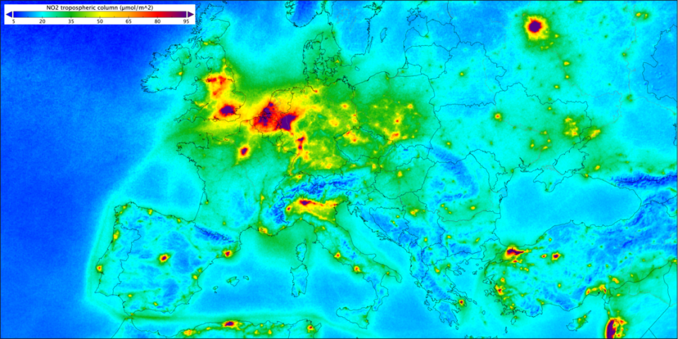
Nitrogen dioxide over Europe
The satellite carries the most advanced sensor of its type to date: Tropomi. This state-of-the-art instrument detects the unique fingerprint of atmospheric gases to image air pollutants more accurately and at a higher spatial resolution than ever before.
“The European Commission is extremely satisfied with the performance of its satellite,” says Mauro Facchini from the European Commission. “It is a major step forward for Copernicus and European Union’s capacity to monitor air quality.
It has already delivered key information on sulphur dioxide and carbon monoxide, for example. Now measurements gathered between April and September 2018 have been averaged to show exactly where nitrogen dioxide is polluting the air.