Published on 19 August 2022
The frozen parts of the world – including sea ice, ice sheets and glaciers, as well as snow, permafrost and frozen water bodies – are known collectively as the cryosphere. Earth’s polar regions are an important part of the cryosphere, but it also comprises of snowy and icy places between the two poles. These ice-covered areas are a key part of the climate jigsaw, being an important indicator of the long-term changes impacting the planet.
In addition, ice-losses around the world driven by warming global temperatures have impacts that are felt across each of Earth’s systems.
The bright white surface of frozen water reflects a large portion of incoming solar radiation back to space, playing a vital role in global temperature regulation. Some parts of the cryosphere – such as glaciers and icesheets – also influence sea levels by storing huge amounts of water for long periods of time.
Why is it important to monitor changes in the cryosphere?
The cryosphere is a key part of Earth’s climate system, being a sensitive and informative indicator of climate change. By studying these snow and ice covered areas, scientists are improving their understanding of the long-term environmental changes impacting the planet. This is helping to guide policy that aims to reduce the impacts of the climate crisis.
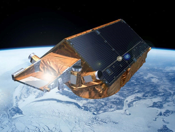
An artist’s impression of CryoSat, part of ESA’s Earth Explorers programme.
ESA’s ice-monitoring mission
In 2010, the European Space Agency (ESA) launched its first mission dedicated to the study of ice. During its 12 years in polar orbit, CryoSat – which is part of ESA’s Earth Explorer programme – has continued to deliver detailed insight into Earth’s frozen zones.
The satellite’s altimeter returns readings of ice height by timing how long it takes for radar waves to bounce back to the satellite from the ice surface. For ice floating in the polar oceans, ice thickness is inferred by measuring the height of the ice above the water.
Data from CryoSat have contributed to numerous scientific publications.