Published on 23 March 2018
The traditional way of mapping Earth’s geology and mineral resources is a costly and time-consuming undertaking. While satellites cannot entirely replace the expert in the field, they can certainly help – as a recent effort in Africa shows.
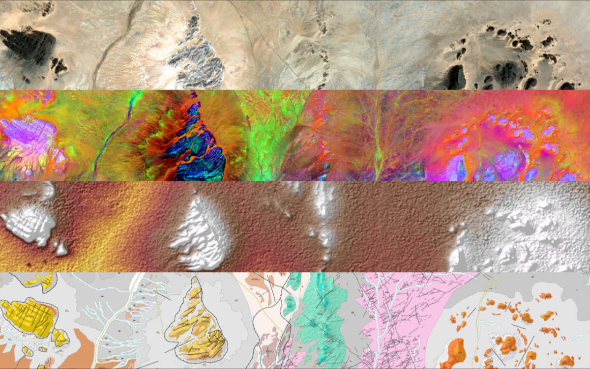
Examples of layers used for mapping
Source: ESA Observing the Earth
Geological maps identify different types of rock, faults, groundwater and deposits. They are not only essential for building infrastructure and assessing risk, but also important for locating and mining natural resources.