Published on 31 August 2022
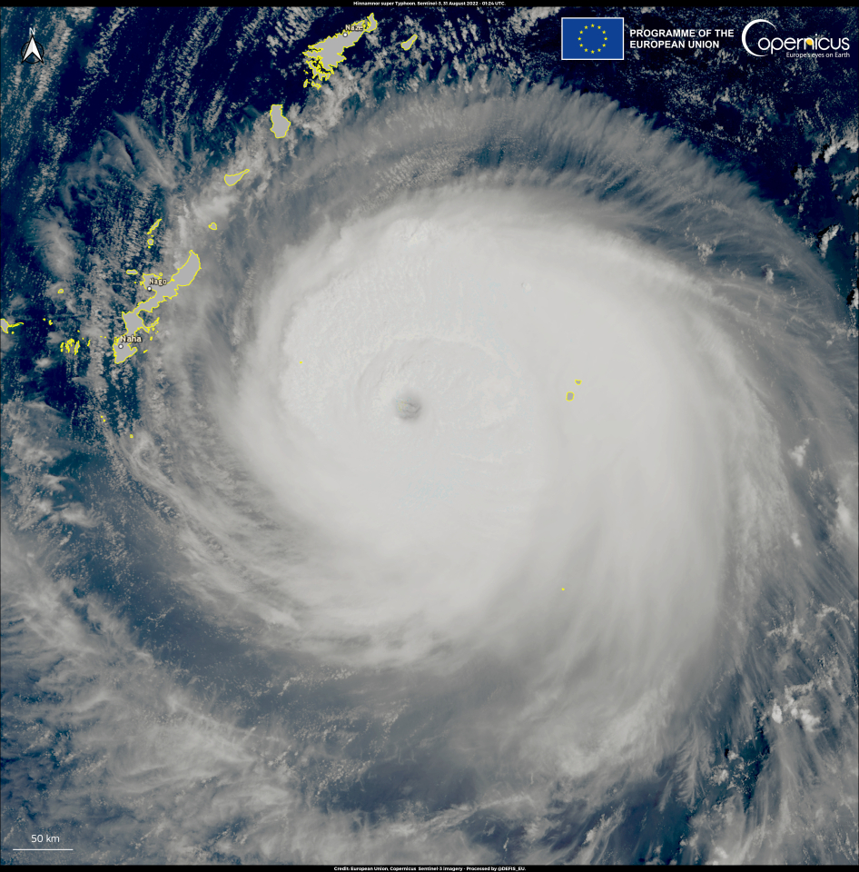
This image, acquired by one of the Copernicus Sentinel-3 satellites on 31 August 2022 at 01:24 UTC, shows Typhoon Hinnamnor in the Pacific Ocean, when it was 250 km east of Okinawa Prefecture in Japan.
Hinnamnor is the strongest tropical cyclone of the 2022 Pacific typhoon season. Its strength has been determined to be equivalent to a Category 5 major hurricane on the Saffir–Simpson Hurricane Wind Scale. According to the latest forecasts, Hinnamnor could impact the Korean Peninsula or southwest Japan in early September.
Data derived from images acquired by the Copernicus Sentinel-3 mission enable improvements in the scientific understanding of the composition of the atmosphere and extreme weather events.
