Published on 19 August 2026
A wildfire broke out on 14 August 2026 in the High Fens nature reserve, in the province of Liège, in eastern Belgium. By 16 August, around 3,000 hectares had burned, making it Belgium’s largest wildfire on record and prompting evacuations from several nearby villages. As of 18 August, the fire was contained, although firefighting operations were continuing in the eastern part of the affected area.
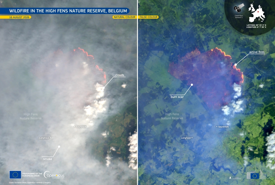
This image, acquired by one of the Copernicus Sentinel-2 satellites on 16 August 2026, is presented in natural and false colour. In the natural-colour view, a dense smoke cover obscures much of the surface across the affected area. The false-colour view uses infrared spectral bands to highlight the burn scar beneath the haze, while active fires appear in bright orange and vegetation in vivid green colours.
The Copernicus Emergency Management Service (CEMS) Rapid Mapping component has been activated (EMSR920) to provide geospatial information on the fire extent and a damage assessment. More information is available here.
Source:
European Commission - DEFIS. (2026, August 19). Wildfire in the High Fens nature reserve, Belgium | EU Space Support Office. EU Space Policy. https://eu-space.europa.eu/components/earth-observation-copernicus/imag…