Published on 6 September 2021
The Netherlands has long been shaped by floods and by efforts to hold back the sea. A spine-like archipelago known as the West Frisian Islands protects the mainland of the country. Just to the south lies the world’s largest system of unbroken mud flats, known as the Wadden Sea. Harbor seals, Eurasian spoonbills, and 10,000 other species of flora and fauna depend on these mudflats for migration and feeding.
The Wadden Sea used to be connected to the bay to the south—known as the Zuiderzee—until the construction of the 32-kilometer (20-mile) Afsluitdijk in 1932. Designed to protect the Netherlands from rising seas, the dam also created a freshwater lake known as Lake IJssel.
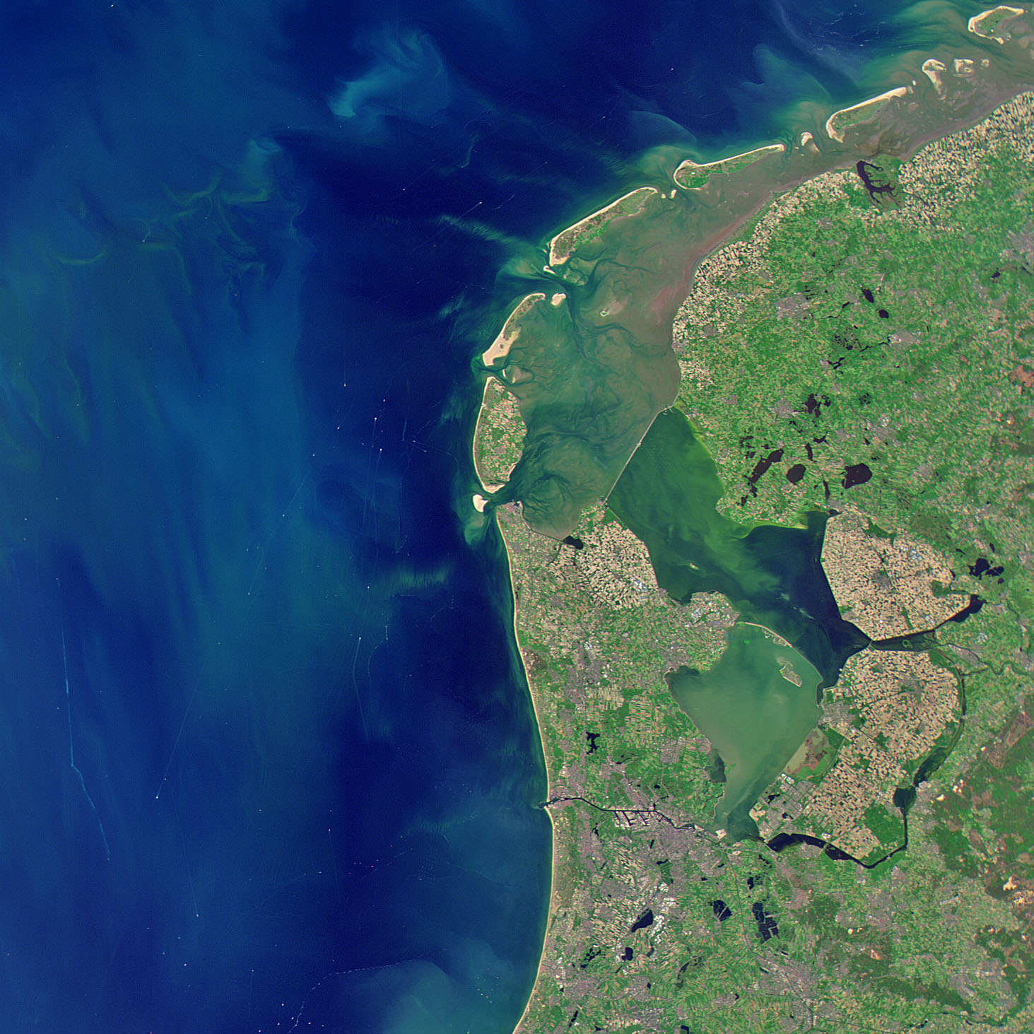
Cutting part of the Zuiderzee off from the North Sea allowed the Dutch to reclaim some of the shallow wetlands behind the dam. The Ministry of Infrastructure and Water Management surrounded the wetlands east of Amsterdam with dikes and drained them for agriculture using wind power. The land created from the diking and draining of wetlands is known as a polder. Roughly 1,620 square kilometers (620 square miles) of land has been reclaimed this way. Collectively, this human-made system of dams, dikes, and polders is known as the Zuiderzee Works.