Context and objectives
![]()
Remote sensing of ocean colour has been used for decades to assess the quality of aquatic systems, of which turbidity and Suspended Particulate Matter (SPM) are key parameters derived. But ocean colour satellite imagery is unable to provide information over a relatively large depth range of the water column. Multibeam echo-sounding (MBES) has this depth range, but fails to assess the top layer of the water column due to the submerged position of the system. Moreover, accurate conversion of acoustic data into reliable turbidity/SPM values is not yet established. The TIMBERS project will tackle this conversion and evaluate methods to merge data from optical remote sensing with MBES to produce 3D turbidity blocks.
Project outcome
Scientific results
The TIMBERS activities led to a complete workflow allowing the generation of 3D SPM datacubes composed by multibeam-derived data at the bottom and SPM values retrieved from satellite imagery at the top.
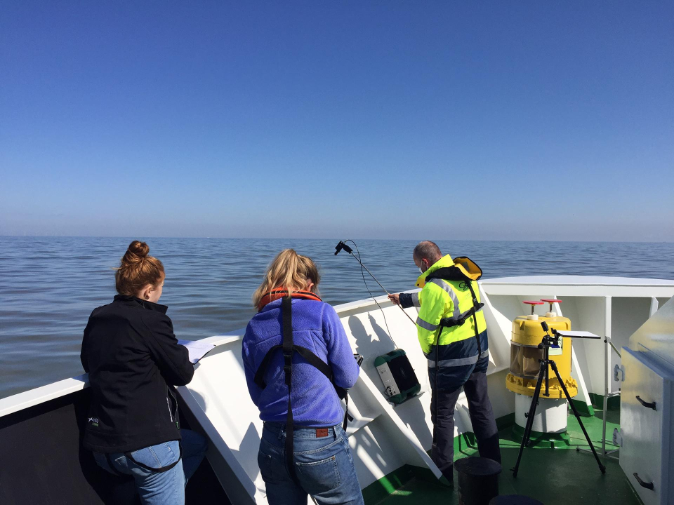
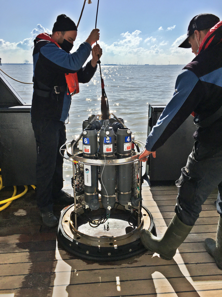
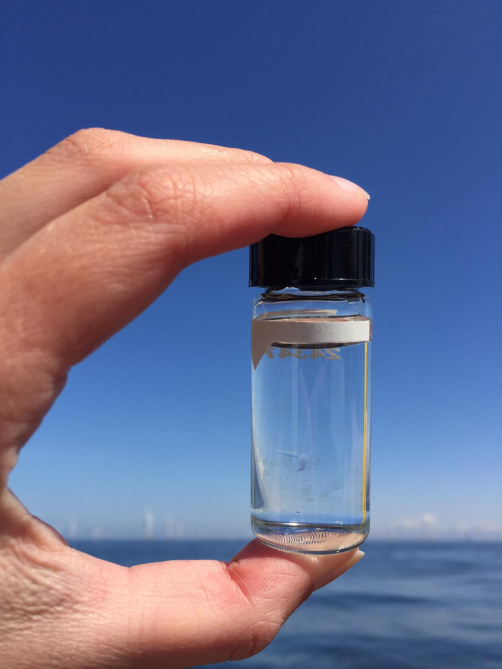
TIMBERS resulted in collection of field data in the Belgian coastal zone including hyperspectral radiometry, LISST particle size distribution, turbidity, and suspended particulate matter (SPM). The radiometry was collected using the handheld WISP sensor and protocols for quality assurance and quality control were developed as part of the project. The QWIP score is published in Frontiers in Remote Sensing.
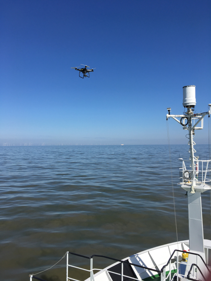
TIMBERS resulted in the analysis of many different remote sensing algorithms for SPM from the Sentinel-2 satellite in Belgian coastal waters using match-up data. The suite of algorithms were not highly predictive of SPM and the team is evaluating the potential causes for this discrepancy. Drone imagery taken concurrent with the ship data revealed that the ship itself could produce plumes of particles that bias the match-up relationships between ship and satellite measurements.
Societal (including environmental) relevance
Monitoring turbid areas in the Belgian Part of the North Sea (BPNS) is important as it is one of the key parameters that can have a detrimental ecological impact. Increasing human activities like the construction of offshore windmill parks and dredging activities may significantly influence SPM variability. Improving our understanding of both natural and human-induced SPM variability is therefore essential for sustainable coastal management.
Products and services
All collected data is made available through MDA (in-situ data), a data paper (WISP data), Terrascope platform (Sentinel-2 turbidity products) or WMS/WCS services (drone data).
Protocols have been developed for
- EM2040 multibeam system;
- LISST-200X processing;
- LISST-200X settings and deployment;
- Water column backscattering processing in Sonarscope
- WISP processing (Dierssen et al., 2022).
Potential users
At the moment our algorithm cannot be regarded as an "end product". However, it can definitely be seen as a proof-of-concept of future 3D turbidity/SPM monitoring tools in the North Sea, which might be interesting for survey and dredging companies, governmental agencies (monitoring SPM and follow-up sand extraction) and scientists.
We are in collaboration with researchers from other satellite communities who are interested in monitoring the 3D particle distribution using the space-borne Lidar ICESAT2. Merging the TIMBERS LISST and acoustic data with ICESAT2 is an excellent proof-of-concept for providing validation of the next generation of ocean space-borne lidars.
Outreach
TIMBERS: where optics and acoustics meet
| Project leader(s): | Vlaams Instituut voor de Zee | |||
| Belgian partner(s) |
|
|||
| Location: |
Continent:
Country:
Region:
|
|||
| Website: | https://timbers.vito.be/en | |||