Programme: STEREO 2
Contract: SR/00/131
Start - End: 30 November 2009 - 29 June 2014
Project type: Thematic network
Context and objectives
Atmosphere and soil conditions largely determine urban habitat quality. Nevertheless, hardly any integrator has been applied, describing urban atmospheric and soil pollution impacts. Biomonitoring of natural vegetation reflects long-term changes of environmental quality, because leaves account for the complex impacts of different air pollutants and accumulate pollution over the growing season. The overall objective is to develop, test and validate a passive biomonitoring methodology based on airborne hyperspectral observations and on a field experimental approach which lapses over several spatial scales as well as over three structural and temporal levels. The specific objectives are:
- the estimation of the spatial distribution of the overall pollution of soil and air;
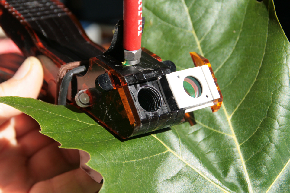
- the investigation at sub-leaf level of the spatial distribution, and seasonal evolution of leaf wettability, stomatal characteristics and chlorophyll fluorescence;
- the investigation at leaf level of the spatial distribution and seasonal evolution of specific leaf area, chlorophyll content, chlorophyll fluorescence and the red edge shift;
- the investigation at canopy level of fluorescence and the red edge shift;
- to compare and validate hyperspectral airborne measurements with these ground measurements for different species, time and test sites; and
- to describe and optimize a protocol for the estimation of urban habitat quality distribution with a high spatial resolution and based on airborne measurements.
Project outcome
- Extensive dataset of leaf level fluorescence, chlorophyll and structure measurements;
- It was shown that stress induced by traffic pollution can be detected by steadystate Fluorescence Yield indices for leaves at the bottom branches of some urban tree species. Susceptibility to air pollution based on solar-induced Chl fluorescence measurements is however found species-dependent;
- Lessons from leaf level solar induced Chl fluorescence for the interpretation of remotely retrieved Chl fluorescence. Insights in the partitioning of bidirectional Chl fluorescence into an upward and downward component, determined by species' specific leaf structure and pigment content should be taken into account in the upscaling of Chl fluorescence from leaf to canopy level and when interpreting the top of canopy Chl fluorescence emittance. A correct estimation of canopy structural parameters (e.g. leaf area index, leaf angle distribution) through reflectance data is necessary for the interpretation of the Chl fluorescence signal obtained via remote sensing;
- It was demonstrated that atmospheric pollutants derived from fuel combustion by motorized traffic (i) can lead to modifications of the physiological functioning of higher plants. (ii) The examined species elicit various responses to traffic exposure;
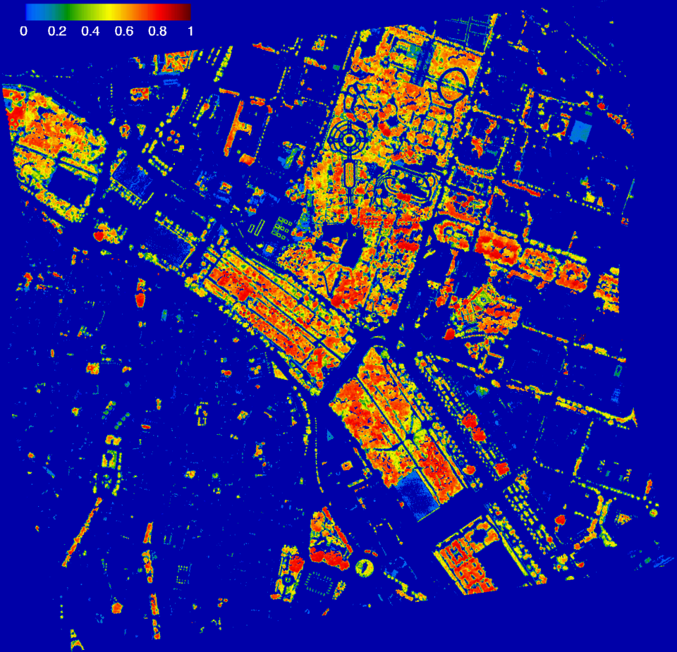
- A detailed Chl map of the city of Valencia, except for use with species with palm-like leaves, based on a robust empirical relationship in urban environments between crown Chl measurements and NAOC index retrieved from high spatial reoslution hyperspectral CASI imagery;
- Identification on the map of trees with low crown Chl levels. These trees indicate areas with a low urban habitat quality and high urban traffic density.
| Project leader(s): | UA - Department Bioscience Engineering | |||
| Belgian partner(s) |
|
|||
| International partner(s) |
|
|||
| Location: |
Country:
Region:
|
|||
| Related presentations: |
|
|||
| Related publications: | ||||
| Website: | http://www.ua.ac.be/biohype | |||