Context and objectives
![]()
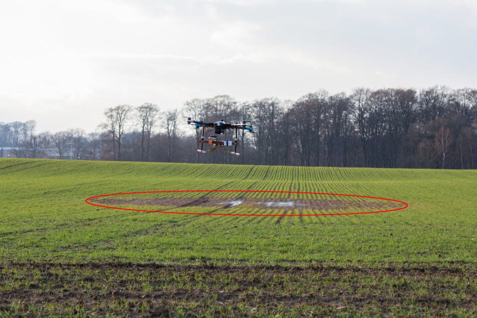
Knowledge of soil properties and dynamics over a range of scales is essential for sustainable management of soil and water resources. Recent advances in soil spectroscopy, ground-penetrating radar (GPR) as well as close range remotely piloted aircraft systems (RPAS) have opened new research avenues for high-resolution, field-scale digital soil mapping and earth observation.
The general objective of the RAPAS project was to develop and apply new drone-borne ground-penetrating radar (GPR) and hyperspectral methods for digital soil mapping. In particular, the project entails the following specific objectives:
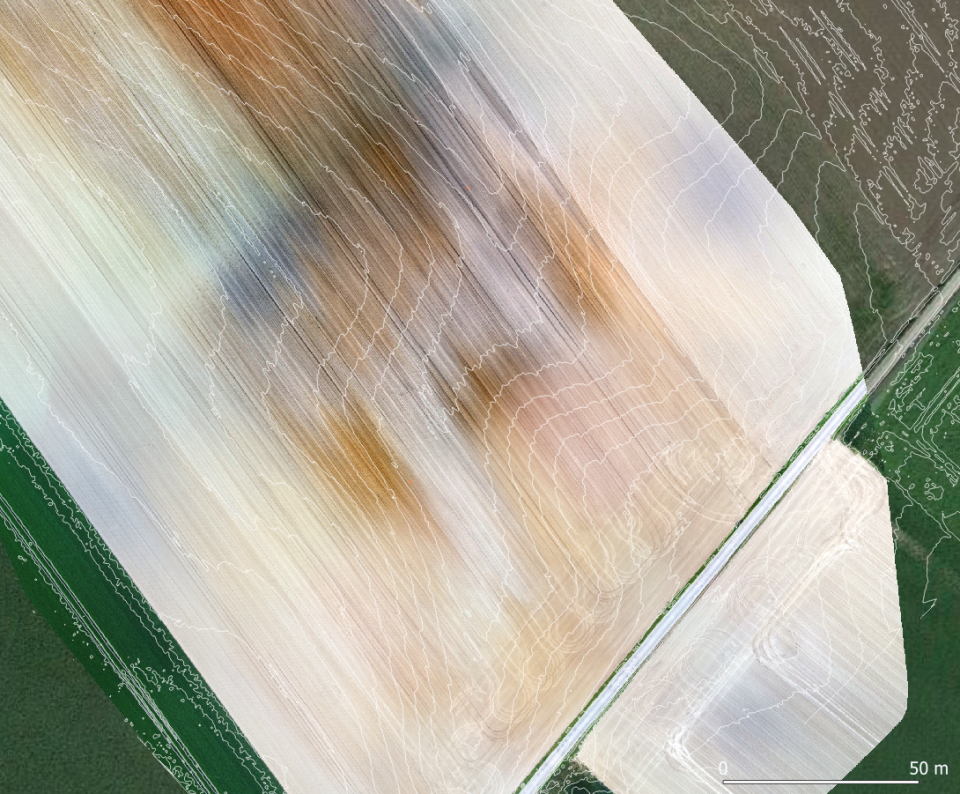
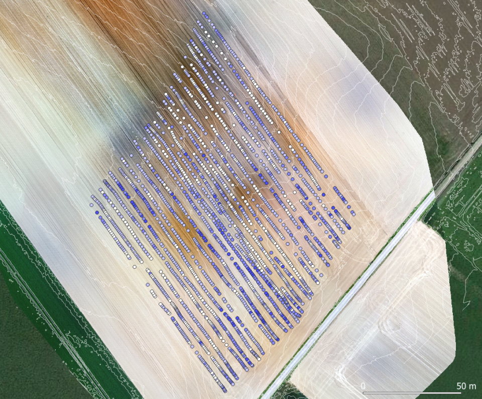
- To setup a new drone-borne GPR system and design specific radar processing algorithms for soil surface and root-zone moisture mapping at the field scale.
- To setup a new drone-borne spectrometer and advanced processing strategies to map soil organic carbon. In particular, it was proposed to use the radar-derived soil moisture maps to remove the soil moisture effects from the soil spectrum in order to improve carbon content estimates.
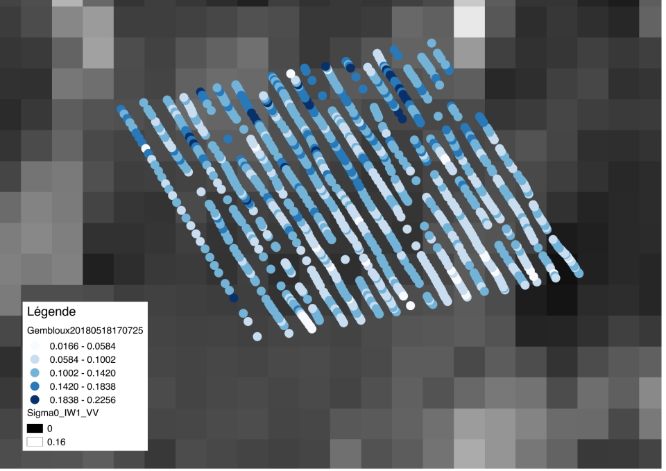
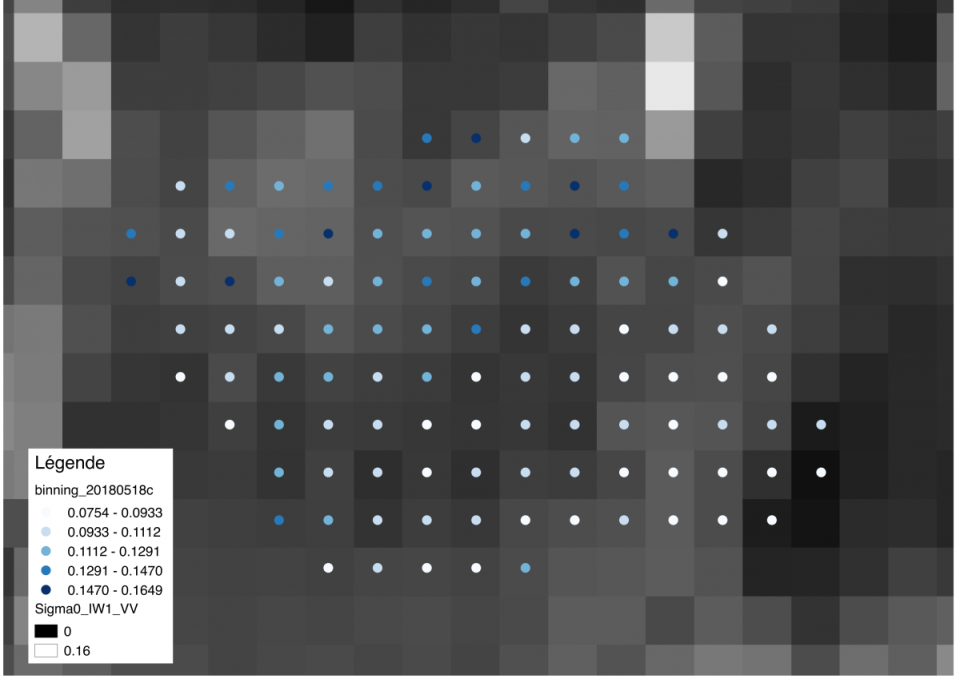
- To use the drone-GPR information for a tentative up-scaling of derived soil moisture data based on Sentinel-1 data, for larger scale soil moisture characterization.
Project outcome
Scientific results
High-resolution soil moisture maps were obtained on several fields using the newly developed droneborne georadar. The required tools to proceed to Sentinel-1 calibration in terms of soil moisture were also realised. New instrumentation and processing algorithms were also developed to estimate soil carbon content from drone-based multispectral measurements. Although the results achieved in the project appear to be very promising, further research is needed before the methods can be routinely used in an applied context. Comparing different instruments operating over different scales is complicated by the inherent aerial and depth variability of the soil properties.
Societal (including environmental) relevance
The tools developed during the project open promising application perspectives in the field of precision agriculture. At a larger scale, the RAPAS project opens new avenues of research to bridge the scale gaps between soil sampling and space-borne remote sensing.
Products and services
It is foreseen to improve and then valorise the developments made in this project through the creation of a spin-off for providing digital soil mapping services (e.g., First-Spin Off SENSROAD/GPRSENSING).
Potential users
Scientific research, agriculture.
Outreach
RAPAS: New drone-borne methods for digital soil mapping
| Project leader(s): | UCL - Environmental Sciences | |||||
| Belgian partner(s) |
|
|||||
| Location: |
Continent:
Country:
Region:
|
|||||
| Related presentations: | ||||||
| Website: | https://sites.uclouvain.be/gprlouvain/rapas.php | |||||