Satellite characteristics
Launch Date - End 1669849200 - 1827615600
Status Planned
Orbit type geostationary
Altitude 36,000
Orbit inclination 0°
Orbit period 24h
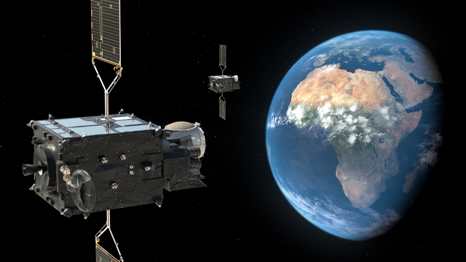
Satellite family: Meteosat Third Generation (MTG)
Severe storms can pose significant and increasing hazards to society. But help is at hand — a new generation of Meteosat satellites will soon be launched, delivering Earth observations of unprecedented range, resolution, and frequency.
Building on the decades-long legacy of Meteosat’s first and second generation satellites, Meteosat Third Generation (MTG) will revolutionise storm prediction, enhance weather forecasts, extend climate records, and provide a wide range of essential observations.
These measurements will underpin services, support livelihoods, and help save lives.
New satellites
MTG is one of the most complex and innovative meteorological geostationary satellite systems ever built. The complete constellation consists of three satellites: two imaging satellites and one sounding satellite, the first operational sounding satellite in a geostationary orbit.
Based on user requirements collected during the planning phase of the programme, MTG will provide near-real-time 3D snapshots of important characteristics of the atmosphere.
 MTG-I instruments

MTG-S instruments
Better weather forecasting
One of the biggest benefits from these observations will be improvements to nowcasting —enabling forecasters to track the development of storms in near-real time and save valuable time in warning about severe and dangerous weather events.
By providing more detail about current weather conditions, MTG will also help improve the accuracy of longer range forecasts. Regular atmospheric soundings will provide more detailed information about developing weather patterns for numerical weather prediction (NWP) models.
MTG is also the first geostationary weather satellite with the capability to detect lightning data across a broad area over Europe, Africa, and the surrounding waters. This data will provide a major boost to very short-term nowcasting and numerical weather prediction models, which support longer-term forecasts.
Climate records
MTG's decades-long mission guarantees a continuity of geostationary data into the future. The long-term, consistent, extensive, and directly comparable datasets provided are invaluable to climate studies. Once MTG satellites reach the end of their mission, EUMETSAT will have amassed more than 60 years of comparative observations.
Essential products and services
Observations taken by MTG satellites will support the development of products and services that can provide major contributions to firefighting, air quality forecasts, air traffic control, search and rescue missions, disaster risk reduction, agricultural productivity, marine and coastal management, sustainable energy production, and much more .
Sensor characteristics
| Sensor name | Lightning Imager (LI) |
|---|---|
| Sensor short description | For the first time over Europe and Africa, the Lightning Imager (LI) provides real-time data on the location and intensity of lightning flashes. Data from the Lightning Imager will enable more precise forecasts of severe thunderstorms. The imager detects all types of lightning: cloud-to-cloud, cloud-to-ground and intra-cloud flashes, thus providing an advantage over ground-based lightning detection networks. The LI is a new instrument on Meteosat, it has no heritage from the Meteosat Second Generation series. The LI uses detector elements arranged in a detector array covering the whole Earth (no scanning mechanism). The total energy received from the photons are sensed by each detector element and integrated during the integration period. These are then compared with the LI trigger threshold and if the energy exceeds this threshold, it is identified as an LI triggered event (Figure 1). |
| Resolution class | Very Low (> 1 km) |
| Spatial resolution | 4.5 km |
| Spectral bandwidth | 777.4 nm |


| Sensor name | Flexible Combined Imager (FCI) |
|---|---|
| Sensor short description | The Flexible Combined Imager (FCI) provides state-of-the-art data over Europe and Africa for forecasting severe weather, and for near real-time monitoring of our changing atmosphere, land surfaces and oceans.
FCI, on the MTG-I satellite, will continue the very successful operation of the Spinning Enhanced Visible and Infrared Imager (SEVIRI) on Meteosat Second Generation (MSG). Requirements have been formulated by regional and global numerical weather prediction (NWP) and nowcasting communities. These requirements are reflected in the design which allows for scanning the full Earth disc in 10 minutes in support of the full disc scanning service (FDSS), or the upper quarter of the disc (i.e., Europe) in 2.5 minutes in support of the rapid scanning service (RSS). The FCI measures in 16 channels in the visible and infrared spectrum of which eight are placed in the solar spectral domain between 0.4µm to 2.2µm, delivering data at a 1km spatial sampling distance (resolution) at nadir (sub-satellite point the centre of the disc). The additional eight channels are in the thermal spectral domain between 3.8µm and 13.3µm, delivering data at 2km spatial sampling distance at nadir. This observation mode is referred to as full disc high spectral resolution imagery (FDHSI) mission. Furthermore, the FCI samples two channels in the solar domain (0.6µm and 2.2µm) at higher spatial sampling distance of 0.5km. and two channels in the thermal domain (3.8µm and 10.5µm) at higher spatial sampling distance of 1km at nadir. This observation mode is referred to as high spatial resolution fast imagery (HRFI) mission. With both missions, the FCI instrument supports the full disc scanning service (FDSS) and the rapid scanning service (RSS). With the FCI on board the MTG-I satellites, Europe will continue to play the leading role in imaging radiometry from the geostationary orbit in the decades to come. |
| Sensor type | Imaging radiometer (Vis/IR) |
| Resolution class | Very Low (> 1 km) |
| Spatial resolution | 1.0 km |