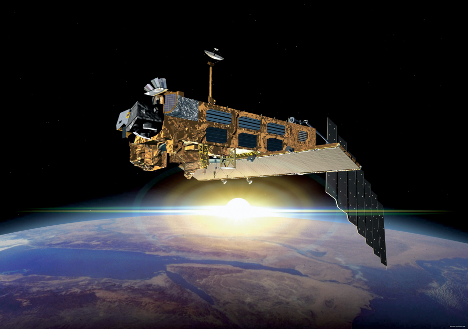
In March 2002, the European Space Agency launched ENVISAT (ENVIronmental SATellite), an advanced polar-orbiting Earth observation satellite which provides measurements of the atmosphere, ocean, land, and ice.
The eight-tonne satellite orbited Earth more than 50 000 times over 10 years – twice its planned lifetime. The mission delivered thousands of images and a wealth of data used to study the workings of the Earth system, including insights into factors contributing to climate change.
Contact with Envisat was lost on 8 April 2012. Following rigorous attempts to re-establish contact and the investigation of failure scenarios, the end of the mission was declared on 9 May 2012.
But ten years of Envisat’s archived data continues to be exploited for studying our planet.
The Envisat satellite had an ambitious payload of 10 instruments ensuring the continuity of the data measurements of the ESA ERS satellites. Envisat data has supported Earth science research and allowed monitoring of the evolution of environmental and climatic changes. Furthermore, the data has facilitated the development of operational and commercial applications.
The main objective of the Envisat programme was to endow Europe with an enhanced capability for remote sensing observation of Earth from space, with the aim of further increasing the capacity of participating states to take part in the studying and monitoring of the Earth and its environment.
Its primary objectives were:
- to provide for continuity of the observations started with the ERS satellites, including those obtained from radar-based observations;
- to enhance the ERS mission, notably the ocean and ice mission;
- to extend the range of parameters observed to meet the need of increasing knowledge of the factors determining the environment;
- to make a significant contribution to environmental studies, notably in the area of atmospheric chemistry and ocean studies (including marine biology).
These are coupled with two linked secondary objectives:
- to allow more effective monitoring and management of the Earth's resources;
- to better understand solid Earth processes.
Satellite characteristics
Launch Date - End 1014850800 - 1333749600
Status Decommissioned
Orbit type Near-circular sun-synchronous orbit
Altitude 800
Orbit inclination 98.55
Equatorial crossing time 10:00:00
Orbit period 100.6
Sensor characteristics
| Sensor name | AATSR (Advanced Along Track Scanning Radiometer) |
|---|---|
| Sensor short description | |
| Sensor type | Imaging radiometer (Vis/IR) |
| Resolution class | Very Low (> 1 km) |
| Swath width (at nadir) | 500 km |
| Max look angle | 47 ° |
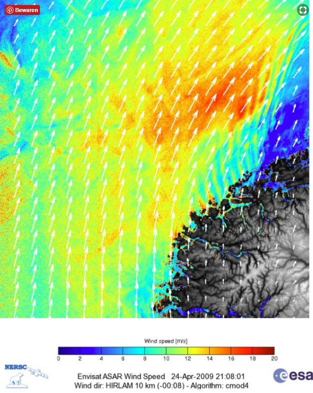
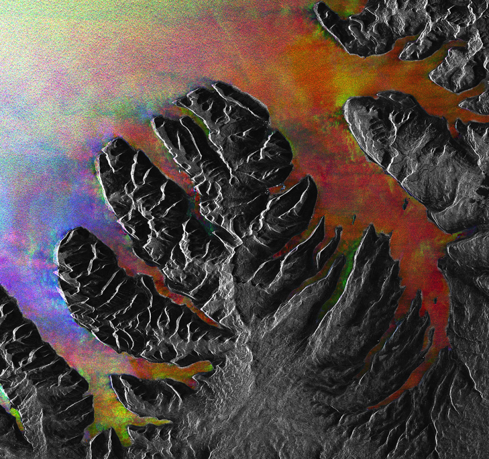
| Sensor name | ASAR (Advanced SAR) |
|---|---|
| Sensor short description | |
| Sensor type | Imaging microwave radar |
| Resolution class | Medium (30 - 300 m) |
| Swath width (at nadir) | 100 km |
| Max look angle | 45 ° |
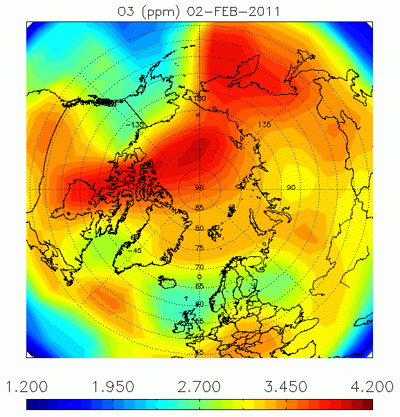
| Sensor name | GOMOS (Global Ozone Monitoring by Occultation of Stars) |
|---|---|
| Sensor short description | |
| Sensor type | Atmospheric instrument |
| Resolution class | NA |
| Max look angle | 91 ° |
| Sensor name | LRR (Laser Retroreflector) |
|---|---|
| Sensor short description | |
| Sensor type | Lidar |
| Resolution class | NA |
| Max look angle | 60 ° |
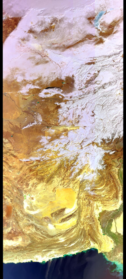
| Sensor name | MERIS (Medium Resolution Imaging Spectrometer) |
|---|---|
| Sensor short description | The MERIS instrument is a programmable spectrometer allowing data recording in 15 spectral bands in the 390 – 1040 nm range and with a spatial resolution of 1040 x 1200 m for marine applications and of 2360 x 300 m for land and coastal applications. |
| Sensor type | Imaging radiometer (Vis/IR) |
| Resolution class | Medium (30 - 300 m) |
| Swath width (at nadir) | 1150 km |
| Revisit frequency | 3 days |
| Max look angle | 68 ° |
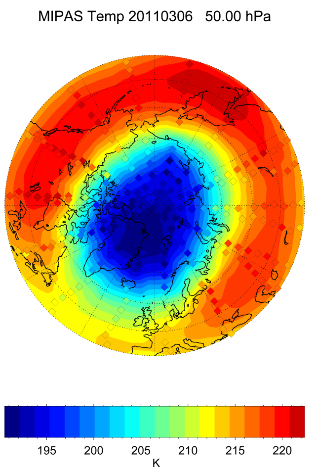
| Sensor name | MIPAS (Michelson Interferometer for Passive Atmospheric Sounding) |
|---|---|
| Sensor short description | |
| Sensor type | Atmospheric instrument |
| Resolution class | Very Low (> 1 km) |
| Revisit frequency | 35 days |
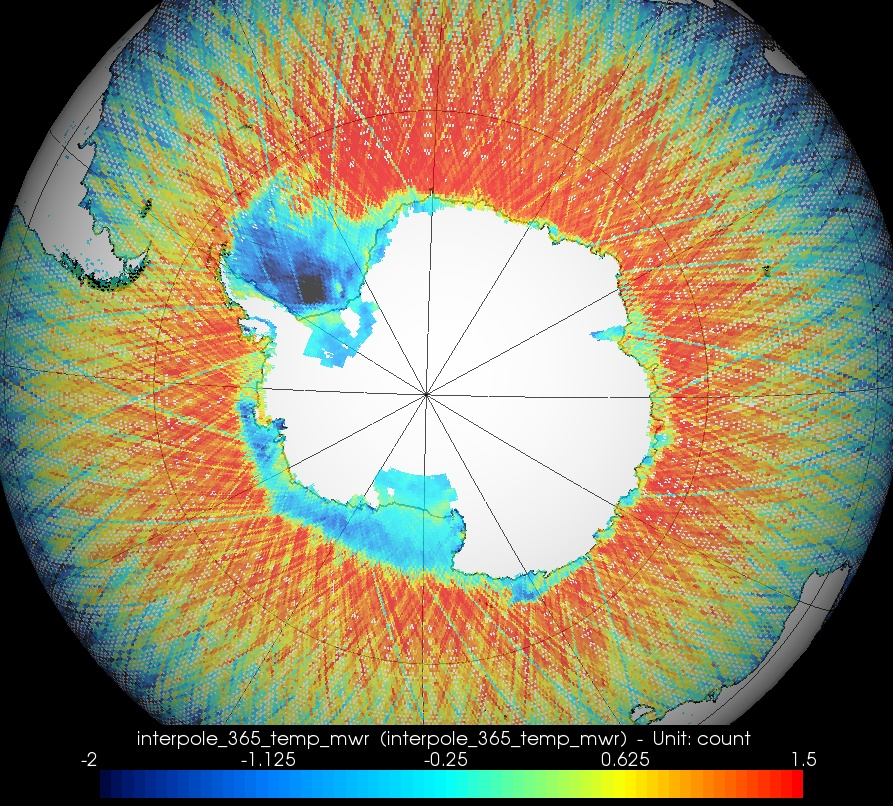
| Sensor name | MWR (Microwave Radiometer) |
|---|---|
| Sensor short description | MWR is a nadir-viewing, two-channel Dicke-type radiometer (passive sensor). The main objectives of MWR is the measurement of atmospheric humidity as supplementary information for tropospheric path correction of the RA-2 signal, which is influenced by the integrated atmospheric water content and by liquid water. In addition, MWR measurements are useful for the determination of surface emissivity and soil moisture of land, for surface energy budget estimations, investigations to support atmospheric studies, and for ice characterization. |
| Sensor type | Imaging radiometer (passive microwave) |
| Resolution class | Very Low (> 1 km) |
| Spectral bandwidth | 23.8 (K-band) and 36.5 (Ka-band) GHz |
| Swath width (at nadir) | 20 km |
| Max look angle | 47 ° |
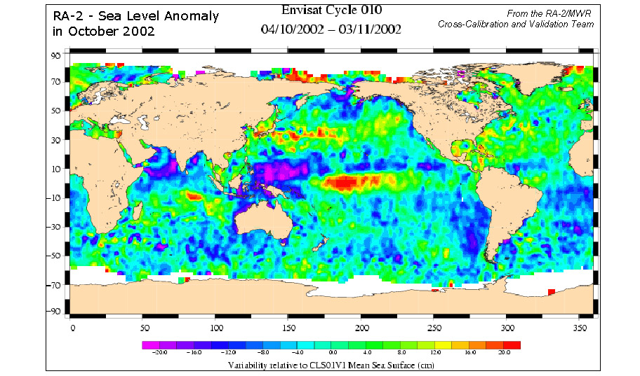
| Sensor name | RA-2 (Radar Altimeter-2) |
|---|---|
| Sensor short description | |
| Sensor type | Radar altimeter |
| Resolution class | NA |
| Sensor name | SCIAMACHY (Scanning Imaging Absorption SpectroMeter for Atmospheric CartographY) |
|---|---|
| Sensor short description | |
| Sensor type | Atmospheric instrument |
| Resolution class | Very Low (> 1 km) |
| Swath width (at nadir) | 1000 km |
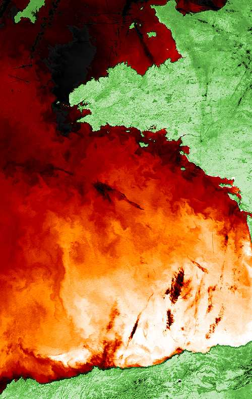
The 10 instruments onboard Envisat were designed to study Earth’s land, ocean, atmosphere and ice caps. The collected data from the various sensors can be used to:
- study environmental and climate changes on Earth at the local, regional and global levels
- contribute to the management and monitoring of all raw materials, whether renewable or not
- continue measurements to serve the meteorological community
- acquire a better understanding of the dynamic and structure of the Eearth's crust and interior.
Among the parameters that can be studied, we can mention: ocean colour, cloud cover, ozone layer thickness, greenhouse gas emissions, terrestrial biomass, iceberg topography, wave height, soil moisture content or the top-of-atmosphere irradiance.