Programme: STEREO 3
Contract: SR/67/315
Start - End: 1 June 2014 - 31 May 2018
Project type: Shared cost
Context and objectives
![]()
![]()
- The biodiversity conservation policy of the European Commission includes the development of warning and rapid response systems for biological invasions and urges further investigations of their impacts on ecosystem function and services.
- Remote sensing technology provides a promising avenue to upscaling the level of observations of biological invasion, It is yet largely underexplored and underused by ecologists.
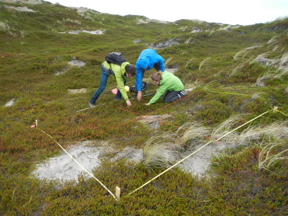
- DIARS aimed at better demonstrating and characterizing the impact of invasive species on ecosystems through the combined use of field data and data obtained through remote-sensing technologies. It also aimed at supporting monitoring, prediction of spread and risk assessment of invasive plant species through remote sensing as preconditions for taking management measures for mitigation.
Project outcome
Scientific results
The DIARS project resulted in 18 international peer-reviewed publications and several presentations at international fora. Main results are
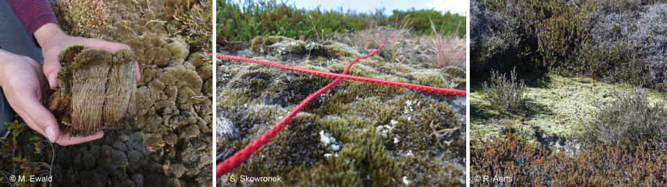
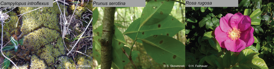
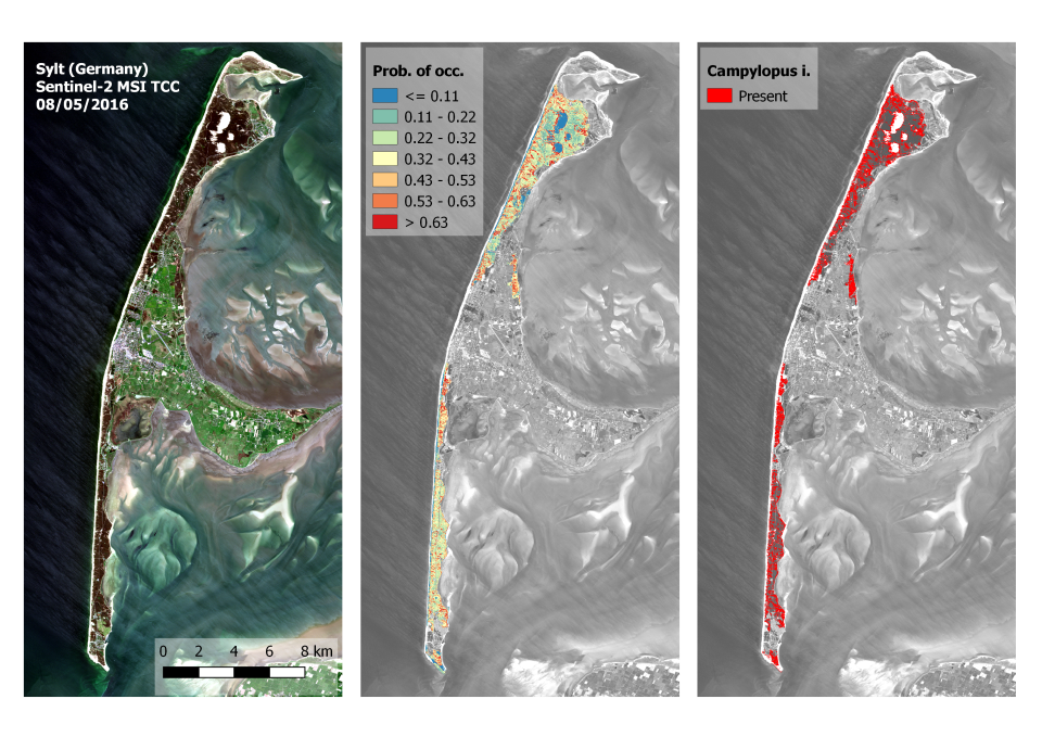
- The ability of airborne hyperspectral remote sensing data to generate reliable distribution maps of Campylopus introflexus, a non-native highly invasive moss species: link
- A novel sampling design tuned to IAS in order to collect presence–absence data which can be use as input for species distribution models: link
- We successfully showed that our mapping methodology for IAS can be transferred to other areas, hence limiting the collection of additional field data: link
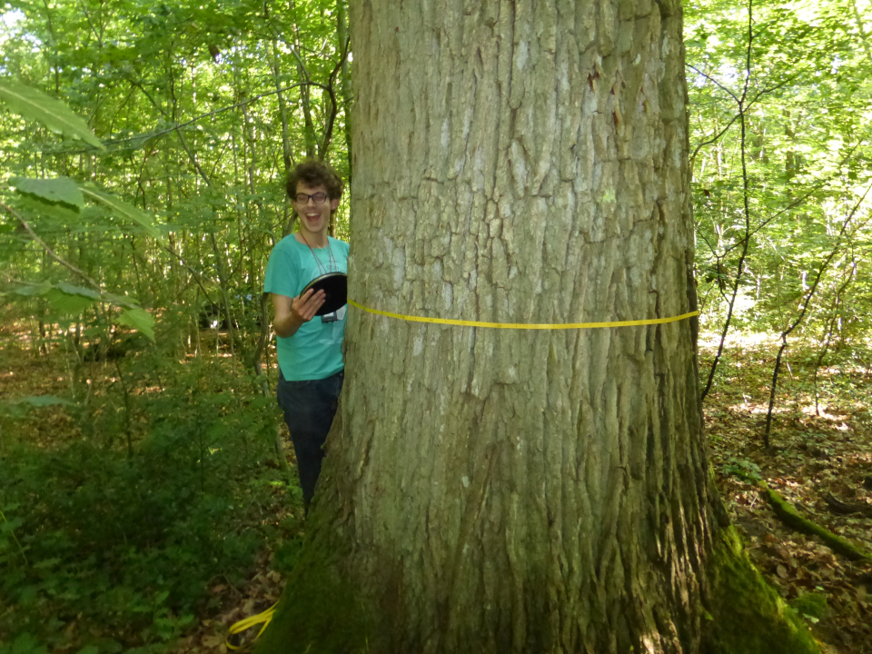
- We demonstrated that LiDAR-derived data can be combined together with hyperspectral bands to model leaf nutrient content (nitrogen, phosphor) in the tree canopy at very fine spatial resolution (link) as well as we quantified the impact of Prunus serotina on structural and leaf chemical vegetation traits (link and link)
Products and services
- Fine-resolution baseline maps and scenarios of the distribution of invasive plant species at the landscape scale
- The DIARS toolbox: a free and open-access toolbox (cf. the DIARS toolbox) with:
- Open-source codes to be used in the free and open source software (FOSS) R and GRASS GIS;
- A new R package (cf. iSDM: https://cran.r-project.org/web/packages/iSDM/);
- Guidelines;
- Hands-on training based on real data collected throughout the DIARS project. The DIARS toolbox and its iSDM companion ensure a proper knowledge transfer that aims at engaging and educating stakeholders and end users.
Potential users
Ecologists, conservation biologists, policy makers and landscape managers across Europe.
Outreach
DIARS: images against invasive plants
| Project leader(s): | European Commission - Joint Research Centre (JRC) | |||||
| Belgian partner(s) |
|
|||||
| Location: |
Region:
|
|||||
| Related presentations: | ||||||
| Website: | http://diars.vgt.vito.be | |||||