Context and objectives
![]()
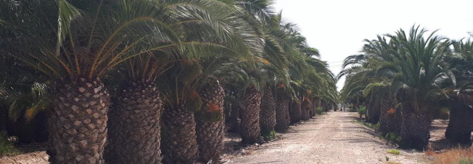
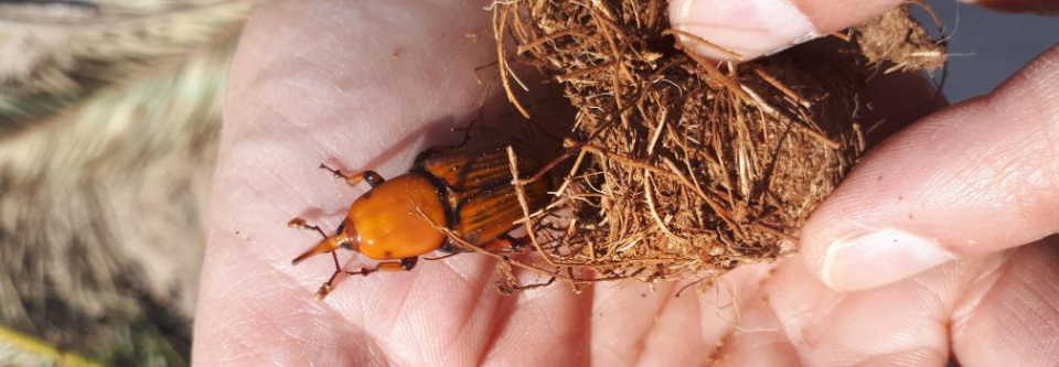
Red Palm Weevil (RPW) is considered as a key pest of palms with immense economic and environmental impacts, with consequences on food security and rural community livelihood in date palm oases. Adult weevils colonize the palms as they fly between them, while transnational infestations are due to the trade of infested plants. Direct losses due to RPW can be attributed to the value of the destroyed palms and, for date palms, the consecutive loss of date production, in addition to the high cost of the management programs, notwithstanding the expenses incurred on the removal and disposal of infested palms. It is clear that for a proper monitoring of RPW, it is essential to work on the complete set of contextual, structural, spatial, spectral and temporal information available from remote sensing. Spatially detailed multidate observations are rare, while they can provide information on the phenology and might significantly improve the accuracy and time of the RPW detection throughout the season. Furthermore, the spatial distribution of pest abundance and damage can be mapped without a large number of samples and provide spatial approaches for pest control.
The PALMWATCH project investigated whether detection of red palm weevil infestation is feasible using airborne and spaceborne remote sensing (RS) techniques. An assessment was made at what stage of the infestation a confident RPW detection can be provided, and which RS data is needed for this purpose.
An evaluation of the current remote sensing technologies, both airborne and spaceborne, for the monitoring of RPW infestations will be made.
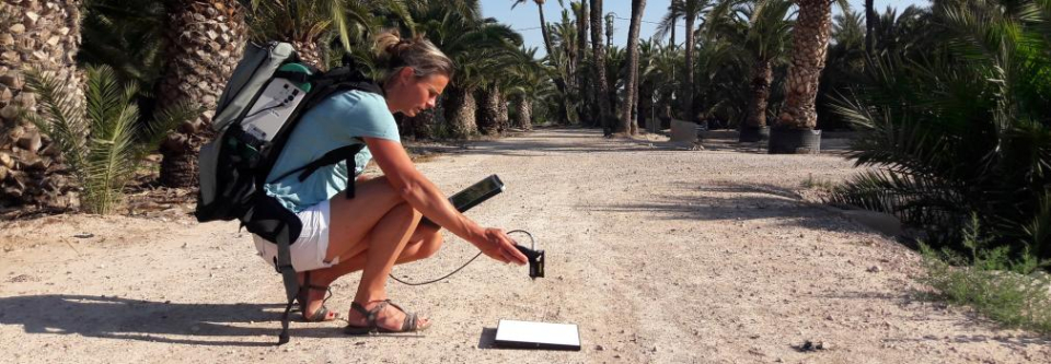
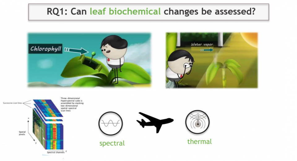
An evaluation will be made on the need of high temporal resolution to monitor the development of the disease over time, the spatial resolution to monitor individual trees and even leaves in detail, as well as the spectral resolution to detect subtle changes due to RPW. An innovative RS monitoring system will be set-up for a non-destructive, effective detection of RPW infestations, bearing in mind an operational service resulting from this project.
Considering the missing links and future recommendations from literature, we believe that the PALMWATCH project could accomplish a major step forward in the realization of a RPW detection system. Timeseries of Pleiades, Sentinel 1 (S1) and 2 (S2) satellite images will be used to evaluate their potential for RPW detection. An integrated multi-sensor RS monitoring system will be set-up in order to find the most optimal RPW detection system, focusing on timely RPW detection and more generally on the adequate identification and localization of infested palms.
Four main work packages were defined to address this goal: application review (WP2000), data collection and preprocessing (WP3000), local (WP4000), and regional RPW mapping (WP5000). Two other work packages dealt with project management (WP1000) and dissemination (WP6000).
Project outcome
Scientfic results
A multi-sensor RS monitoring system was set-up in order to find the most optimal RPW detection system, focusing on the adequate identification and localization of infested palms.
Specific results on individual palm tree detection using deep learning on aerial orthophotos are detailed in Culman et al., 2020. Results establish that the proposed approach is suitable for training a model that maps palm trees and achieves a mean absolute error of 0.44 trees per pixel in the tree density estimation and balanced accuracy of 89.25% in the tree cover area segmentation. In total, we map 1,078,917 Phoenix palm trees that collectively cover an area of 35.38 km2 across the entire Alicante province (5816 km2) and make our results publicly available online. The tree density map could serve as a first-level tool for the demographic analysis of tree populations.
More information on our palm density mapping method with deep learning using S1 and S2 spaceborne imagery can be found in Culman, et al. 2021. We developed the first region-wide spatial inventory of Phoenix dactylifera (date palm) and Phoenix canariensis (canary palm) trees, based on remote imagery from the Alicante province in Spain. The best performing model was capable of mapping Phoenix palms in different scenes, with a changeable appearance, and with varied ages, achieving a mean average precision (mAP) value of 0.861. In total, 511,095 Phoenix palms with a probability score above 0.5 were detected over an area of 5816 km2. The detection model, which was obtained from an out-of-the-box object detector, RetinaNet, provides a fast and straightforward method to map isolated and densely distributed date and canary palms—and other Phoenix palms.
A dedicated processing workflow for UAV based image analysis was set-up, with concentric canopy statistics to limit the impact of the intrinsic heterogeneity inside the palm 422 crown on the detection results. The experimental results indicate that thermal imagery is the most valuable information for RPW infestation prediction. However, the internal temperature does not always corresponds with external crown temperatures, which makes the RPW infestation detection based on drone imagery more challenging and thermal effects less pronounced. Only maximum temperature and standard deviations of the temperature within the crown revealed good discriminatory performance between infested and healthy palms from June onwards. Mean crown temperatures were only informative at a progressed infestation stage.
Societal (including environmental) relevance
This plague has wiped out many palm farms in various countries, and constitutes a severe agricultural problem. In Gulf countries and the Middle East, $8 millions are spent, every year, only to remove infested palm trees. By 2023, in Italy, Spain and France, it is expected that RPW control and loss of benefits will amount to around $225 million.
Products and services
A dedicated drone based processing workflow and visualisation platform through mapeo.
Potential users
Date farm companies, FAO, Biobest, Koppert, Smart Farm Sensing, UP42.
Outreach
PALMWATCH: Remote sensing to the rescue of palm trees
| Project leader(s): | VITO - Remote Sensing - Teledetectie en aardobservatieprocessen | |
| Location: |
Country:
Region:
|
|
| Related presentations: | ||
| Website: | https://remotesensing.vito.be/case/palmwatch | |