Published on 15 March 2022
Overview of the HRL Vegetated Land Cover Characteristics (VLCC) product portfolio
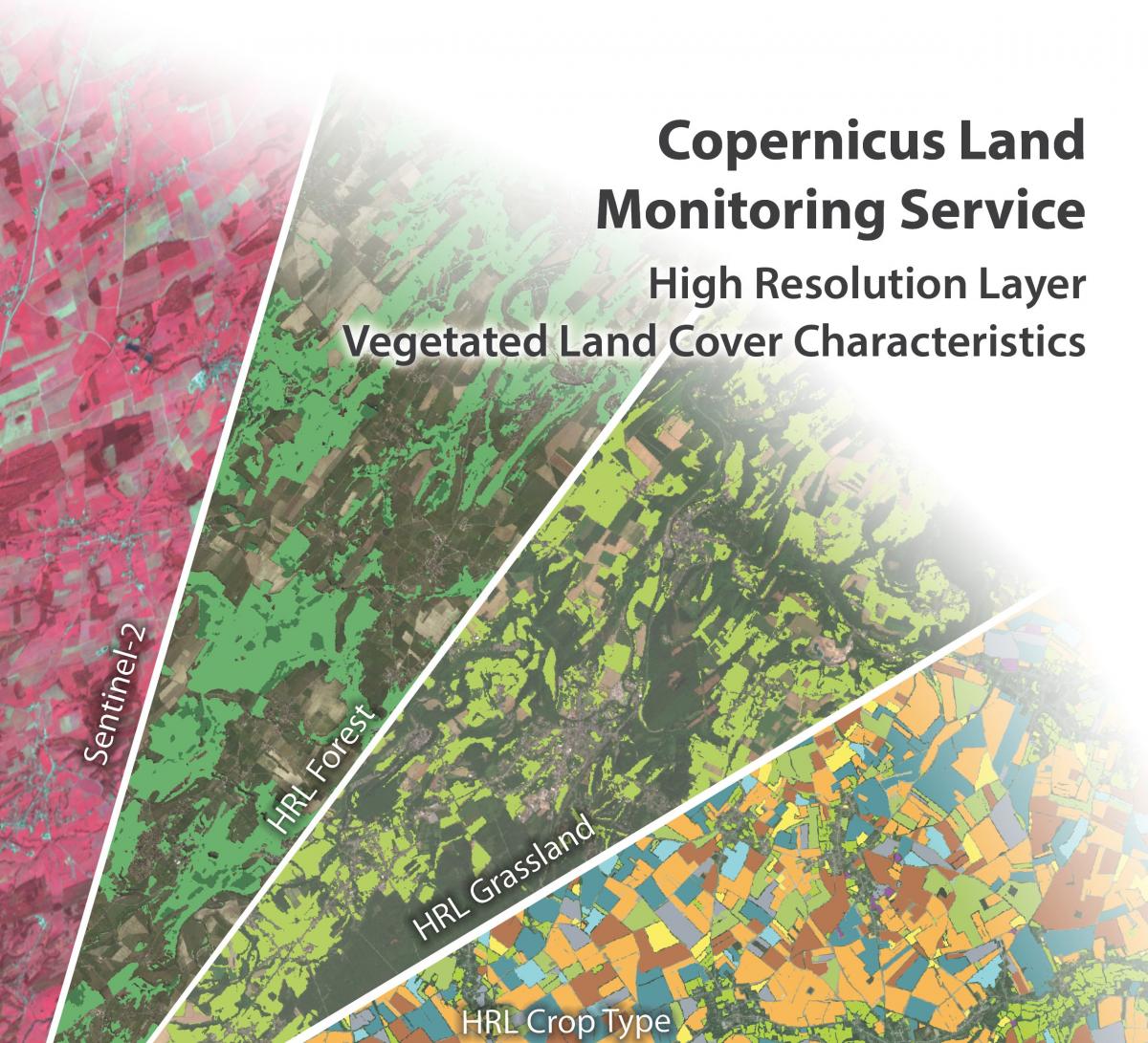
With the new HRL Vegetated Land Cover Characteristics (VLCC), the European Environment Agency (EEA) will substantially extend and integrate the information content of its high-resolution vegetation monitoring products. The new VLCC will ensure continuity and further densification of the well-established HRL Forest and Grassland product time series. Furthermore, it will also shed additional light on a part of the European vegetation where decision makers need higher detailed and quality information for analysis and planning.
André Stumpf, VLCC project manager at GAF
In particular, the HRL VLCC will comprise pan-European mapping of several new agriculture-related CLMS products such as annual crop types, agricultural cropping patterns and grassland mowing until the year 2023, while ensuring consistency with the grassland and forest products. The VLCC will form part of the pan-European component of the Copernicus Land Monitoring Service (CLMS), making regular large-scale information products available to a broad user community from European public bodies, to EEA member and cooperating countries, regional environmental authorities, research and academia as well as the value-adding sector. It will provide support for various environmental policies and make a significant contribution to assessing Europe's current environmental status and monitoring changes over time.
All related methodological and operational challenges will be addressed by a consortium with a long CLMS production track record, composed of GAF (Germany), GeoVille (Austria) and VITO (Belgium), supported by CLS (France) for independent validation and Evenflow (Belgium) for user involvement and dissemination. This team's combined thematic and operational experience, together with application of the latest technologies, will ensure a fully compliant and sustainable project implementation that has a high level of consistency with the existing CLMS product portfolio.