Published on 18 February 2022
The release of Landsat 9 imagery stands as a major milestone for the Landsat Program, which began 50 years ago with the launch of Landsat 1, then known as the Earth Resources and Technology Satellite (ERTS).
“Landsat 9 is distinctive among Earth observation missions because it carries the honor to extend the 50-year Landsat observational record into the next 50 years,” said Chris Crawford, USGS Landsat 9 Project Scientist, who works at the USGS Earth Resources Observation and Science (EROS) Center near Sioux Falls, SD. “Partnered in orbit with Landsat 8, Landsat 9 will ensure continued eight-day global land and near-shore revisit.”
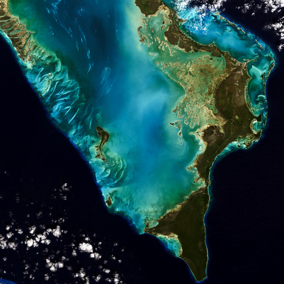
Natural color image of Eleuthera Island, the Bahamas, as seen by Landsat 9 on January 18, 2022. Between Landsat 8 and Landsat 9, the Landsat program delivers complete coverage of the Earth’s surface every eight days. Landsat Scene ID LC09_L1TP_013042_20220118_20220118_02_T1
Click here to view the image at full resolution.
Crawford is co-chair of the Landsat Science Team (LST), which met virtually to discuss the impending release of Landsat 9 data on February 9, 2022. The LST includes members from the Federal government, academia, the private sector, and international organizations. It provides a voice for the global scientific community, which relies on the Landsat mission to provide a landscape-level view of the land surface, surface waters (inland lakes and rivers) and coastal zones, as well as to document the changes that occur from both natural processes and human-induced activity.