Published on 29 September 2021
After Cumbre Vieja split open and began erupting on September 19, 2021, a slow-moving wall of basaltic lava began bulldozing its way through populated parts of La Palma. Lava flows have destroyed nearly 400 homes, buried dozens of kilometers of roads, and consumed farmland as molten rock creeps down the western flank of the volcanic island toward the ocean.
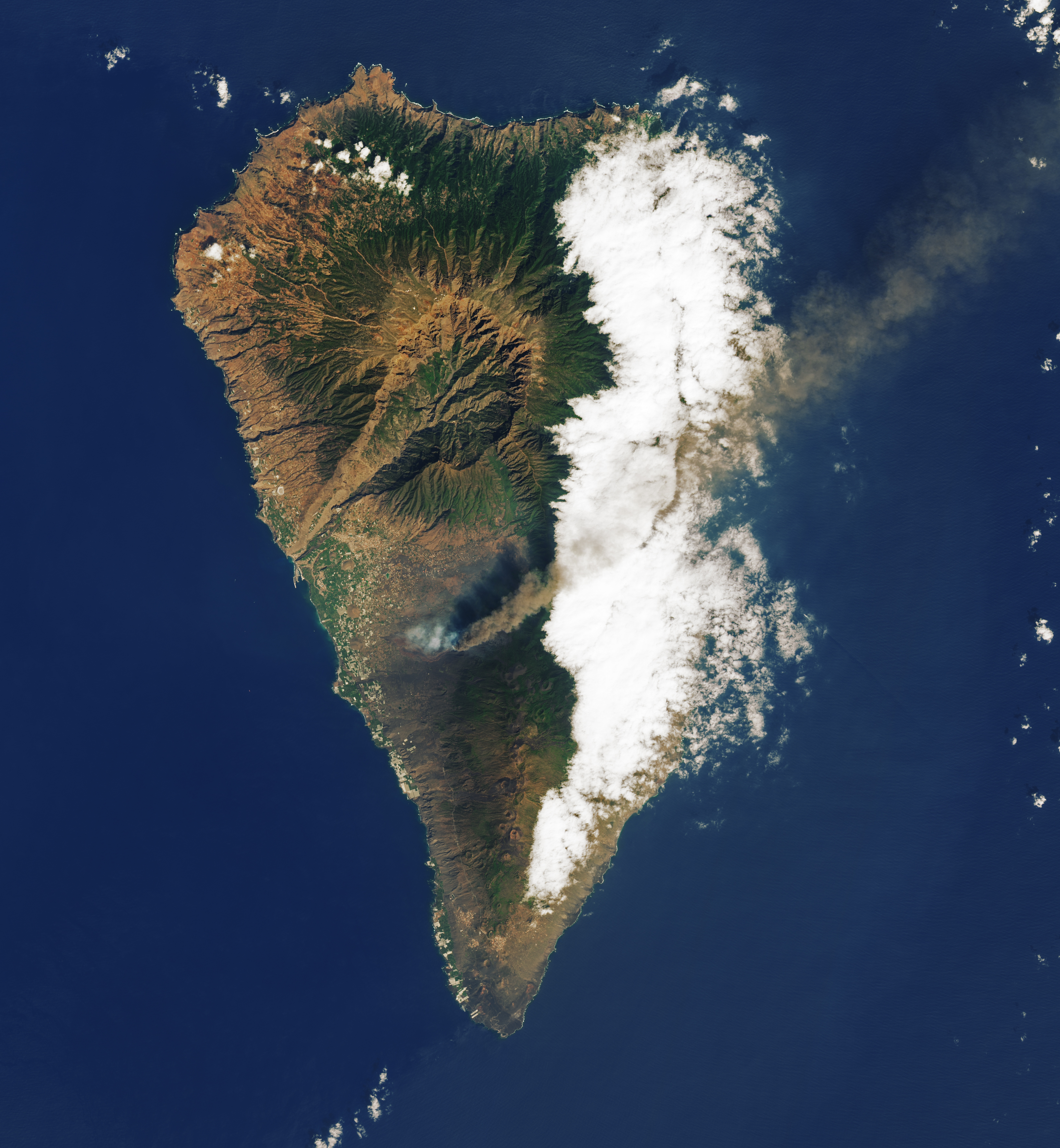
The Operational Land Imager (OLI) on Landsat 8 captured a natural-color image (above) of lava flowing through the communities of El Paraiso and Todoque on September 26, 2021. Though the inside of the lava flow was hot and molten, cooling on the surface left a dark crust that made the flow appear black in natural-color imagery. Observations of infrared wavelengths (second image below) reveal the hottest parts of the flow.
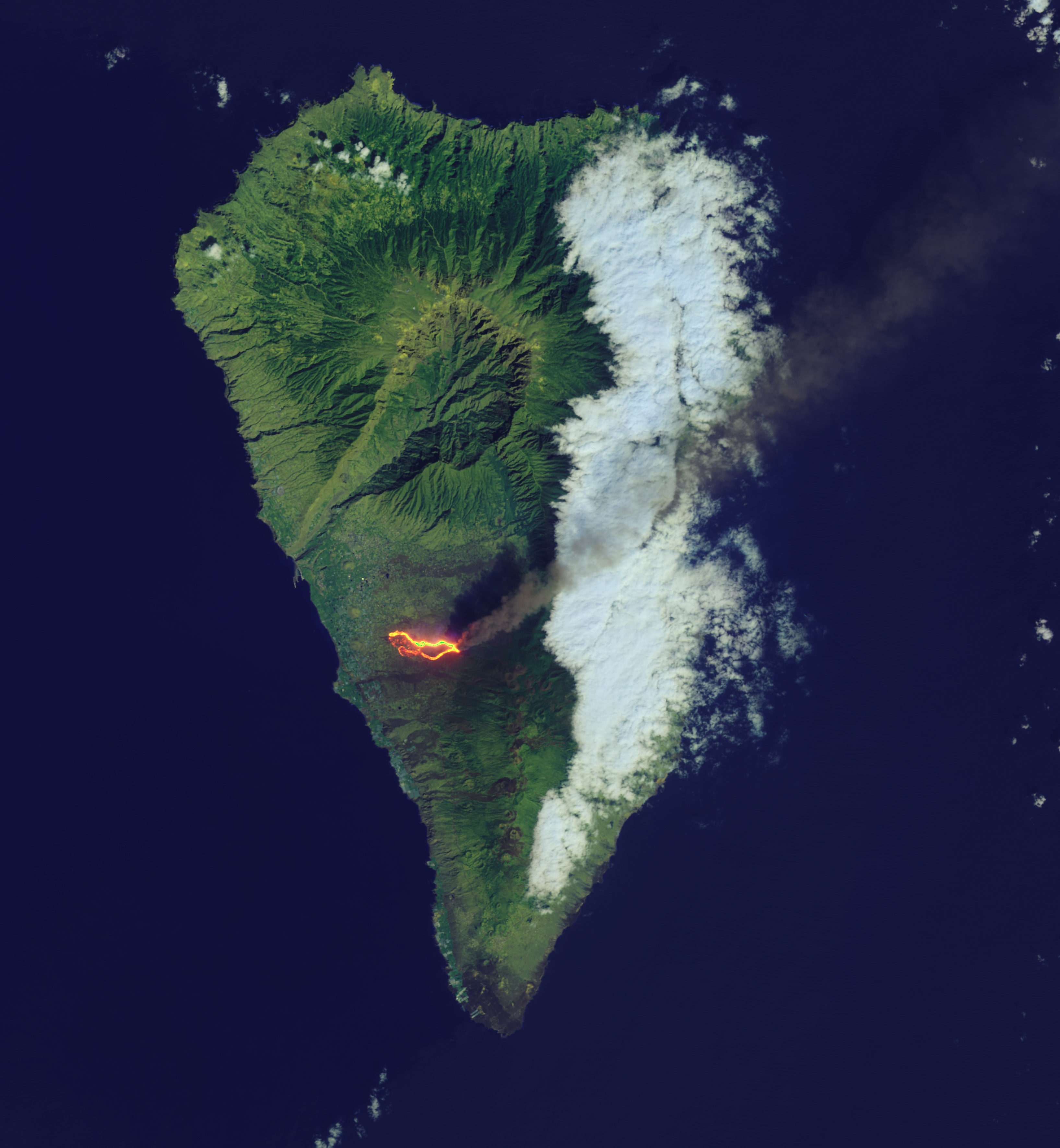
Many of the white rectangular features near the coast are greenhouses. The dark green areas along the coast are crops, likely fields of bananas. The volcanic plume streaming toward the northeast contains a mixture of ash, sulfur dioxide, and other volcanic gases.