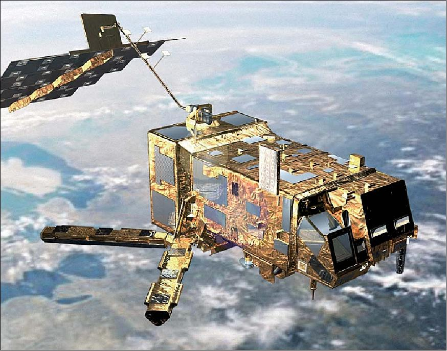

Satellite characteristics
Launch Date - End 1161122400 -
Status Operational
Orbit type Near-circular sun-synchronous polar morning orbit
Altitude 817
Orbit inclination 98.7
Equatorial crossing time 09:30:00
Satellite family: MetOp (Operational Meteorological Satellites)
The Meteorological Operational satellite programme (MetOp) is a new European undertaking providing weather data services that will be used to monitor climate and improve weather forecasts. The MetOp programme’s series of three satellites has been jointly established by ESA and the European Organisation for the Exploitation of Meteorological Satellites (EUMETSAT), forming the space segment of EUMETSAT's Polar System (EPS).Sensor characteristics
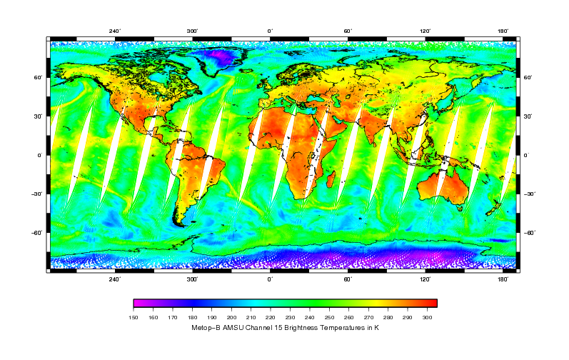
| Sensor name | AMSU (Advanced Microwave Sounding Unit) |
|---|---|
| Sensor short description | |
| Sensor type | Atmospheric instrument |
| Resolution class | Very Low (> 1 km) |
| Swath width (at nadir) | 1690 km |
| Revisit frequency | 1 days |
| Max look angle | 50 ° |
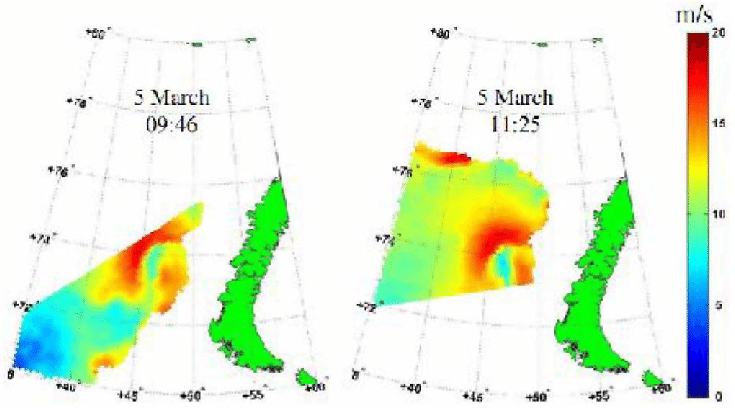
| Sensor name | ASCAT (Advanced Wind Scatterometer) |
|---|---|
| Sensor short description | |
| Sensor type | Scatterometer |
| Resolution class | NA |
| Swath width (at nadir) | 500 km |
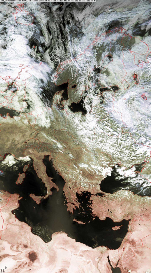
| Sensor name | AVHRR3 (Advanced Very High Resolution Radiometer 3) |
|---|---|
| Sensor short description | |
| Sensor type | Imaging radiometer (Vis/IR) |
| Resolution class | Very Low (> 1 km) |
| Swath width (at nadir) | 2900 km |
| Revisit frequency | 1 days |
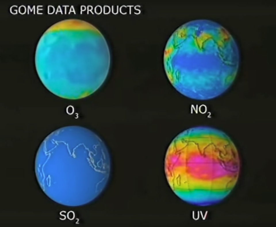
| Sensor name | GOME-2 (Global Ozone Monitoring Experiment-2) |
|---|---|
| Sensor short description | |
| Sensor type | Atmospheric instrument |
| Resolution class | NA |
| Swath width (at nadir) | 960 km |
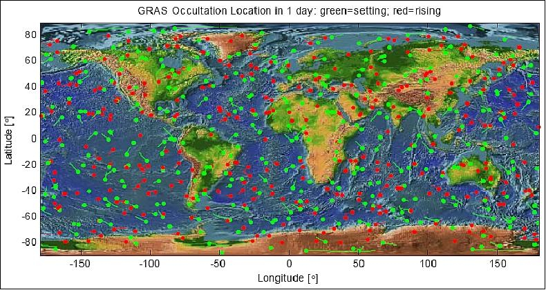
| Sensor name | GRAS (GNSS Receiver for Atmospheric Sounding) |
|---|---|
| Sensor short description | |
| Sensor type | Atmospheric instrument |
| Resolution class | Very Low (> 1 km) |
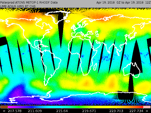
| Sensor name | HIRS (High Resolution Infrared Radiation Sounder) |
|---|---|
| Sensor short description | |
| Sensor type | Imaging radiometer (Vis/IR) |
| Resolution class | Very Low (> 1 km) |
| Sensor name | IASI (Improved Atmospheric Sounder Interferometer) |
|---|---|
| Sensor short description | |
| Sensor type | Atmospheric instrument |
| Resolution class | NA |
| Swath width (at nadir) | 2000 km |
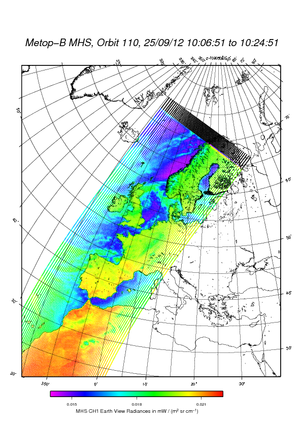
| Sensor name | MHS (Microwave Humidity Sounder) |
|---|---|
| Sensor short description | |
| Sensor type | Atmospheric instrument |
| Resolution class | NA |
| Swath width (at nadir) | 2000 km |