Satellite characteristics
Launch Date - End 25 April 2018 -
Status Operational
Orbit type Polar, sun-synchronous
Altitude 814.5
Orbit inclination 98.65
Equatorial crossing time 10:00:00
Orbit period 101
Satellite family: Sentinel missions
ESA is developing a new family of missions called Sentinels specifically for the operational needs of the Copernicus programme.
Each Sentinel mission is based on a constellation of two satellites to fulfil revisit and coverage requirements, providing robust datasets for Copernicus Services.
These missions carry a range of technologies, such as radar and multi-spectral imaging instruments for land, ocean and atmospheric monitoring:
- Sentinel-1 is a polar-orbiting, all-weather, day-and-night radar imaging mission for land and ocean services. Sentinel-1A was launched on 3 April 2014 and Sentinel-1B on 25 April 2016. Both were taken into orbit on a Soyuz rocket from Europe's Spaceport in French Guiana.
- Sentinel-2 is a polar-orbiting, multispectral high-resolution imaging mission for land monitoring to provide, for example, imagery of vegetation, soil and water cover, inland waterways and coastal areas. Sentinel-2 can also deliver information for emergency services. Sentinel-2A was launched on 23 June 2015 and Sentinel-2B followed on 7 March 2017.
- Sentinel-3 is a multi-instrument mission to measure sea-surface topography, sea- and land-surface temperature, ocean colour and land colour with high-end accuracy and reliability. The mission will support ocean forecasting systems, as well as environmental and climate monitoring. Sentinel-3A was launched on 16 February 2016.
- Sentinel-4 is a payload devoted to atmospheric monitoring that will be embarked upon a Meteosat Third Generation-Sounder (MTG-S) satellite in geostationary orbit.
- Sentinel-5 is a payload that will monitor the atmosphere from polar orbit aboard a MetOp Second Generation satellite.
More information: Sentinel online
Sensor characteristics
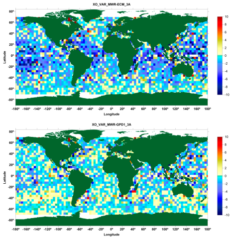
| Sensor name | MRW (Microwave Radiometer) |
|---|---|
| Sensor short description | |
| Sensor type | Imaging radiometer (passive microwave) |
| Resolution class | Very Low (> 1 km) |
| Swath width (at nadir) | 20 km |
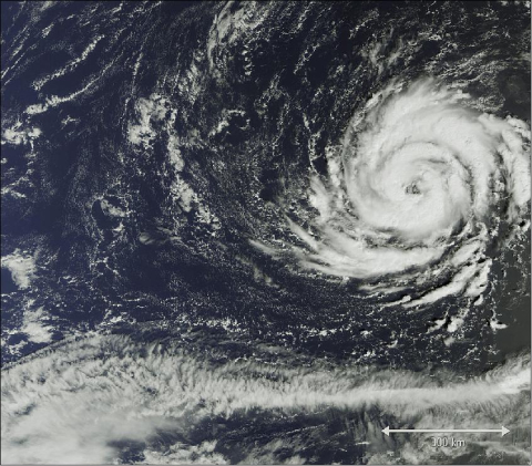
| Sensor name | OLCI (Ocean and Land Colour Instrument) |
|---|---|
| Sensor short description | |
| Sensor type | Imaging radiometer (Vis/IR) |
| Resolution class | Medium (30 - 300 m) |
| Swath width (at nadir) | 1270 km |
| Revisit frequency | 2 days |
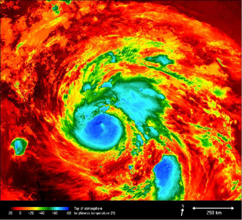
| Sensor name | SLSTR (Sea and Land Surface Temperature Radiometer) |
|---|---|
| Sensor short description | |
| Sensor type | Imaging radiometer (Vis/IR) |
| Resolution class | Low (300 m - 1 km) |
| Swath width (at nadir) | 1400 km |
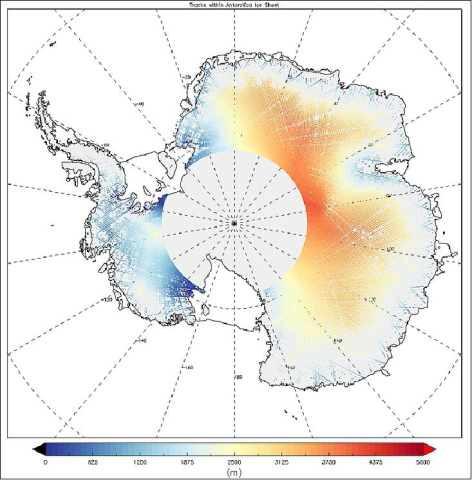
| Sensor name | SRAL (Sentinel-3 Ku/C Radar Altimeter) |
|---|---|
| Sensor short description | |
| Sensor type | Radar altimeter |
| Resolution class | Low (300 m - 1 km) |
