Publié le 24 septembre 2021
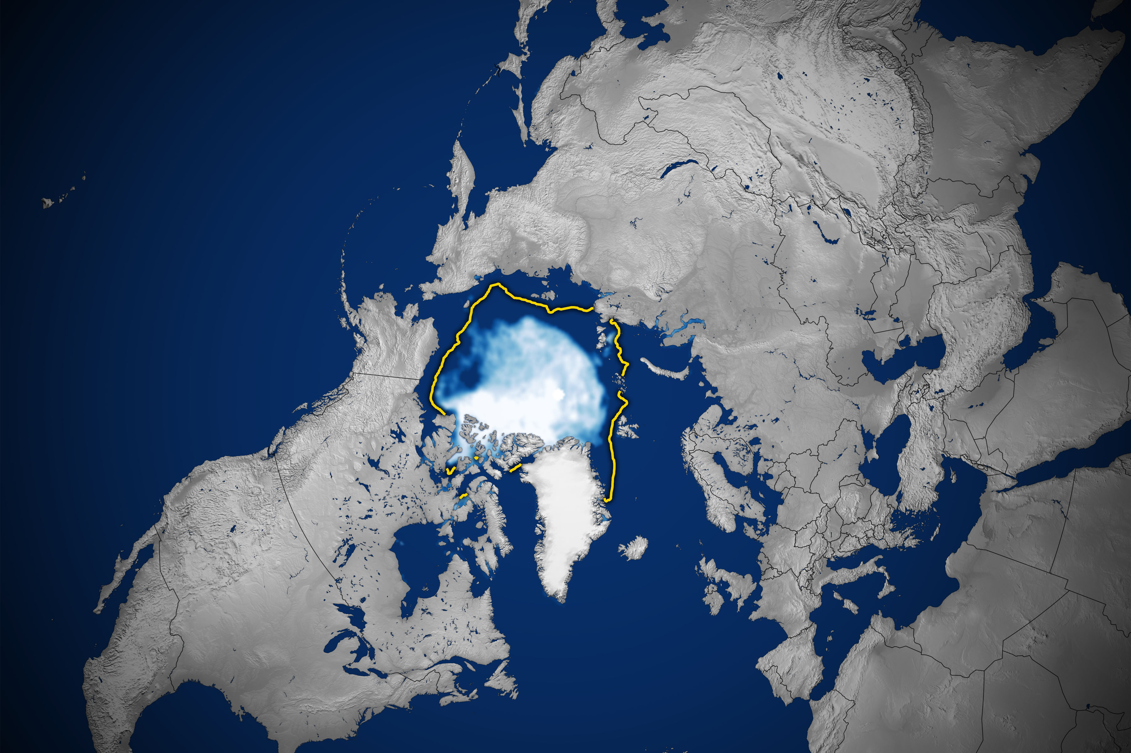
Sea ice in the Arctic Ocean and neighboring basins appears to have hit its annual minimum extent on September 16, 2021, after waning in the spring and summer. The summertime extent is the twelfth lowest in the satellite record, according to scientists at the National Snow and Ice Data Center and NASA.
The map above shows the sea ice extent on September 16, 2021. The ice extent (white) on that day—defined as the total area in which the ice concentration is at least 15 percent—measured 4.72 million square kilometers (1.82 million square miles)—higher than recent years. Sea ice extents in 2020 and 2019 were the second and third lowest on record at 3.74 million square kilometers in 2020 and 4.14 million in 2019.
Less sea ice melted in 2021 even as the planet as a whole was warmer than usual—with new temperature records in North America and Eurasia, drought in the U.S. West, and episodes of intense melting on Greenland’s ice sheet. But farther north, conditions stayed generally cool and stormy across the Arctic Ocean. For much of the summer, low pressure over the Arctic brought cloudy skies, which limits the amount of sunlight that can reach the ice and spur melting. Storms can also spread the ice out, slowing the decline of its extent.
