Publié le 27 octobre 2021
Atafona, like many other settlements on Brazil’s Atlantic coast, is being affected by the consequences of climate change. However, in Atafona, these effects are particularly pronounced.
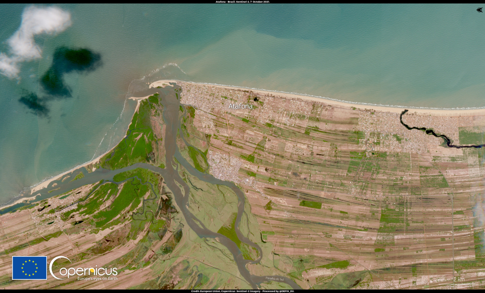
This image, acquired by one of the Copernicus Sentinel-2 satellites on 7 October 2021, shows the coastal area around the town of Atafona, Brazil.
Every year, the Atafona shore retreats an average of about three metres, with a peak of 30 metres between 2008 and 2009. This retreat is a symptom of coastal erosion, accentuated by extreme weather events. The impact has been significant: to date, more than 500 buildings have been swallowed up by the waves and many more are threatened by the advancing waters.
The Copernicus Sentinel-6 Michael Freilich satellite uses radar to measure sea level rise – one of the consequences of climate change.