Publié le 6 août 2022
Long-term datasets drawing on satellite data show that these sweltering conditions are part of a wider global pattern, in which extreme weather events are increasing in frequency and severity. During July, heat warnings were issued across Europe – including the UK, France, Spain and Portugal – with record temperatures being reached in some areas.
Copernicus Sentinel-3 of the European Union’s Copernicus Programme provided a snapshot of this extreme weather by observing land surface temperature, a measure of how hot Earth’s surface would feel to the touch. Scientists monitor the land’s temperature because the warmth rising from Earth’s surface influences weather and climate patterns. These measurements are also used in many industries, including agriculture and urban planning.
Generated from data collected by the satellite’s radiometer instrument, the image below – which captures France, Spain and northern Africa – shows land surface temperatures of 55°C in places.
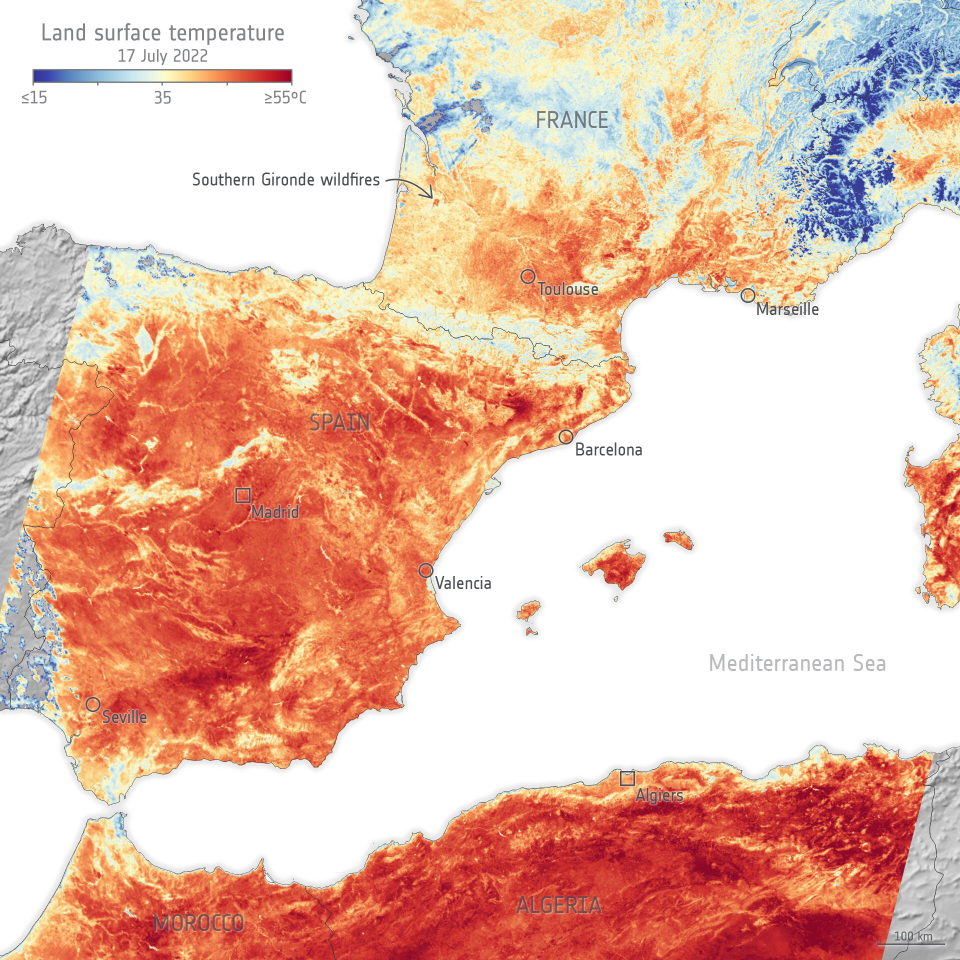
Copernicus Sentinel-3 captures Europe’s heatwave
Across the English Channel in the UK, these temperatures reached 48°C in some central areas, smashing the national record.
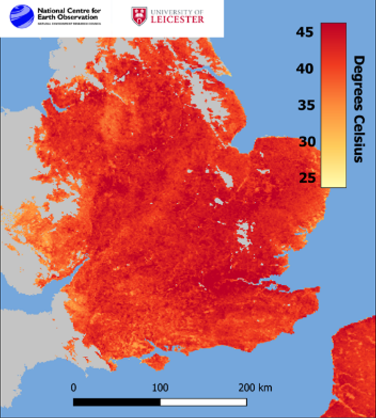
Copernicus Sentinel-3 reveals record UK temperatures
These hot and dry conditions are conducive to the ignition and spread of wildfires, as recently seen across Europe, for example in the southern Gironde region of France.