Publié le 5 mai 2023
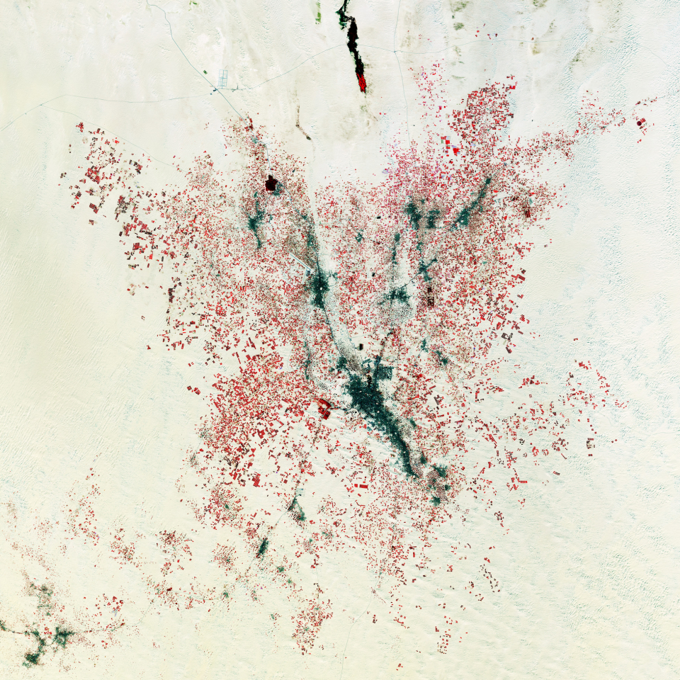
Shown as a dark elongated area in the centre of the image, the town of El Oued lies around an oasis in the northern Sahara, in a region that is otherwise an endless sea of sand.
This false-colour image has been processed using the mission’s near-infrared channel to display vegetation in red, with irrigated vegetation shown in bright red and non-irrigated areas appearing in darker red tones. These vegetated areas stand out clearly in the surrounding gold sand dunes shaped by the wind.
Most of the agricultural fields in the image are circular, indicating that central-pivot irrigation systems are being used. A well, drilled in the centre of each circle, supplies water to rotating sprinklers that spray water in a circular pattern. Each of the circles is around 100 m in diameter. The main crops here include potatoes, onions and tomatoes.
Date palms are also very important for the local economy. They are typically grown using traditional methods inside irregular funnel-shaped fields in the sand. They do not need to be irrigated frequently and can be spotted in dark colours throughout the image, such as around El Oued and to the south of the town of Hassani Abdelkrim, northeast of El Oued.
While providing detailed information about Earth’s vegetation, Copernicus Sentinel-2 plays a key role in mapping differences in land cover to understand how it is used and to track changes over time, so useful for monitoring desertification. The mission also provides measurements of water quality and detects changes in water bodies, supporting sustainable water management – a valuable tool for arid areas where water is scarce.
Source:
European Space Agency. (2023c, May 5). Earth from Space: Farming the desert. ESA Observing the Earth.