Publié le 15 octobre 2026
A wildfire near Bordeaux produced the first pyrocumulonimbus cloud ever observed over France in July 2026. ESA’s EarthCARE satellite caught the process at an early stage, revealing how smoke and aerosols from the fire were already beginning to interact with clouds.
Pyrocumulonimbus clouds, or pyroCbs, form when intense wildfire heat drives smoke, ash and water vapour high into the atmosphere. Under the right conditions, the rising plume can develop into a thunderstorm of its own, complete with strong winds and sometimes lightning.
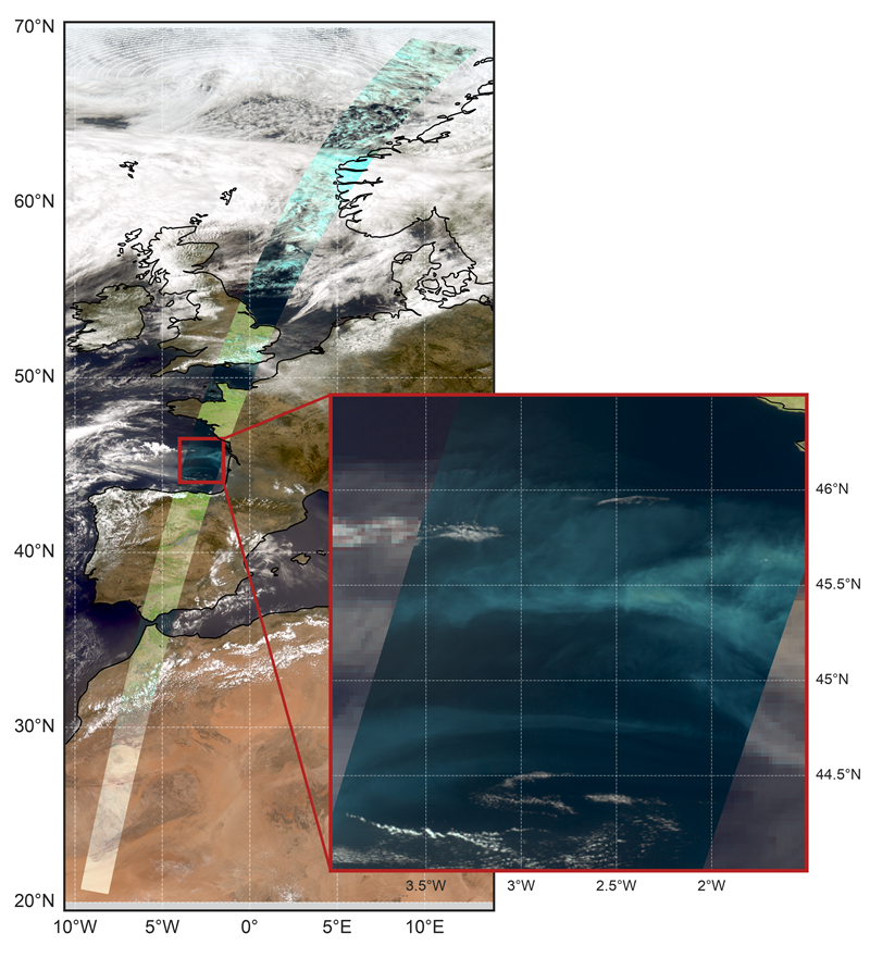
EarthCARE’s multispectral imager captured smoke from the Bordeaux wildfire spreading over the Bay of Biscay on 24 July 2026, during the early development of a rare wildfire-induced thunderstorm.
Image: ESA/EarthCARE
EarthCARE’s measurements showed that the smoke plume contained high concentrations of aerosols already acting as cloud condensation nuclei. Later that day, the plume developed further into a fully fledged pyrocumulonimbus cloud.
The observation demonstrates how EarthCARE can complement weather satellites such as Meteosat Third Generation by revealing not only where wildfire smoke travels, but also how aerosols and clouds interact within the atmosphere.
As extreme wildfire conditions become more common in Europe, observations like these will help scientists better understand how fire-generated clouds influence weather, atmospheric composition and climate.
Based on: European Space Agency (ESA), EarthCARE spots birth of rare fire cloud over Europe, 14 October 2026.