Publié le 30 mai 2023
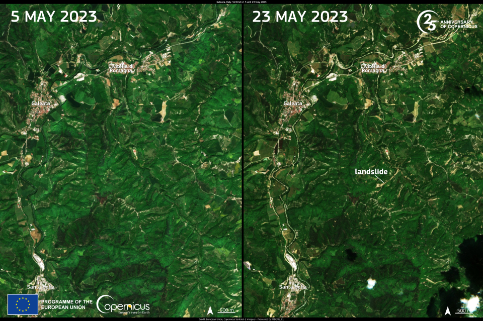
The region of Emilia Romagna, in central Italy, is currently grappling with the aftermath of the devastating flood crisis of the past week. The situation remains challenging, with several landslides triggered by the intense rainfall and saturated soils severely affecting road traffic.
These images, acquired by the Copernicus Sentinel-2 satellites on 5 May 2023 and 23 May 2023, respectively before and after the storm, show the visible changes in the Apennines mountain range caused by the landslides.
The Rapid Mapping module of the Copernicus Emergency Management Service has been activated to identify and monitor the flood and landslide extent in eight different Areas of Interest.
