Publié le 19 janvier 2018
For more than seven years, NOAA’s GOES-13 satellite has been actively monitoring the skies over the Western Hemisphere, serving as a critical source of information during major U.S. weather events, from crippling snowstorms to powerful hurricanes. Here’s a look back at the satellite’s unique history and its most memorable imagery.
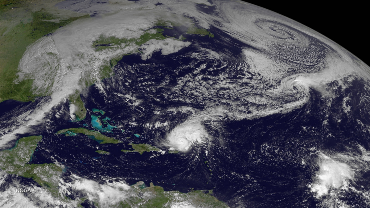
GOES-13 views Hurricane Gonzalo in the Caribbean and active weather across the western and central North Atlantic on October 14, 2014.
Source: NOAA
When GOES-13 was first launched aboard a Boeing Delta-IV rocket from Cape Canaveral Air Force Station in May 2006, the spacecraft joined a new generation of satellites known as the GOES-N,O,P series. These satellites were designed with a longer lifespan than their predecessors, and would carry enough fuel to operate for nearly 14 years.
With faster data processing, GOES-13 could pinpoint the location of severe storms and other weather phenomena with increased accuracy, allowing forecasters to provide timelier warnings to the public. The satellite’s imager and sounder sensors could take more precise vertical measurements of the Earth’s atmosphere, which enabled the satellite to track major weather events such as hurricanes and tropical cyclones in near-real time.