Publié le 16 septembre 2026
A search for a camping spot on satellite maps led to the discovery of a 25-kilometre-wide impact structure in northern Quebec. The crater, now known as Uhackatik, is thought to be around 390 million years old.
Amateur astronomer Joël Lapointe noticed the unusual circular feature near Lake Marsal while browsing satellite imagery. His observation eventually led researchers to the remote site, where they found shatter cones — distinctive rock formations created by the extreme pressures of a meteorite impact.
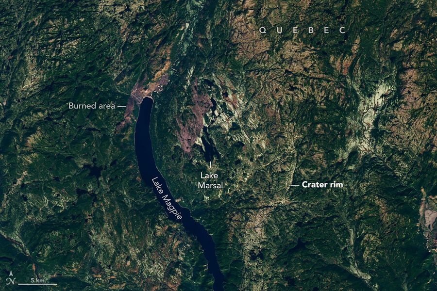
Seen from space, the Uhackatik impact structure reveals a subtle circular outline in the landscape of northern Quebec, with Lake Marsal lying close to its centre. The image was acquired by Landsat 8 on 12 October 2025.
Image: NASA Earth Observatory/Lauren Dauphin, using Landsat data from the U.S. Geological Survey.
The structure is surprisingly difficult to recognise from the ground, but its circular form becomes much clearer from above. A Landsat 8 image acquired in October 2025 shows Lake Marsal close to the centre of the ancient crater.
The discovery is a striking reminder of how satellite imagery can reveal geological structures that may remain almost invisible at ground level.
Based on: NASA Earth Observatory, An Accidental Impact Crater Discovery, September 2026.