Publié le 1 septembre 2023
The study – published in the Journal of Glaciology – represents the first time surging glaciers have been detected systematically on a planetwide scale.
Both Sentinel-1 satellites of the EU’s Copernicus Earth observation programme host a C-band synthetic aperture radar (SAR) instrument that continues to gather observations during the day and night, and under all weather conditions.
This makes the mission a powerful tool for glacier monitoring as these ice flows are typically located in mountainous or polar regions where frequent cloud cover and long periods of darkness often hamper optical observations.
During a surge, glacial ice flows 10 to 100 times more quickly than in normal conditions, which can pose a threat to communities located in downstream areas by triggering severe flooding and even giant ice avalanches.
This massive increase in speed results in stresses that are known to rip flowing ice apart, leaving glaciers covered in a dense network of deep fractures.
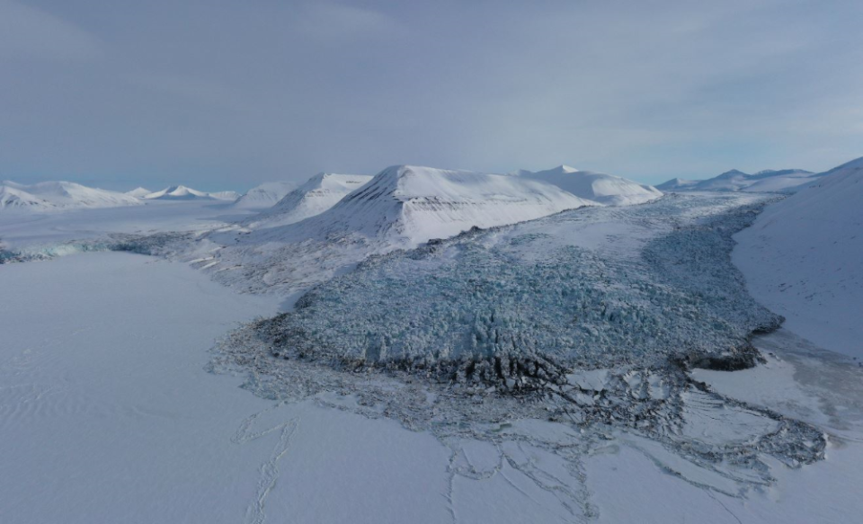
The Scheelebreen glacier in Svalbard experiences a surge
Copernicus Sentinel-1 can measure such changes in surface roughness with a high level of precision, as heavy glacier crevassing during a surge leads to increased backscatter in repeat radar images.
This means that images of glaciers under surge conditions appear brighter than images that capture glaciers moving at a more typical pace.
As part of the study, the research team – made up of scientists from the University of Oslo in Norway and Gamma Remote Sensing in Switzerland – applied image processing to large parts of the entire Sentinel-1 archive to detect glacier surges around the world.
Optical imagery from Copernicus Sentinel-2 also supported the analysis, by enabling scientists to visually confirm the source of the increased backscatter detected by Sentinel-1.
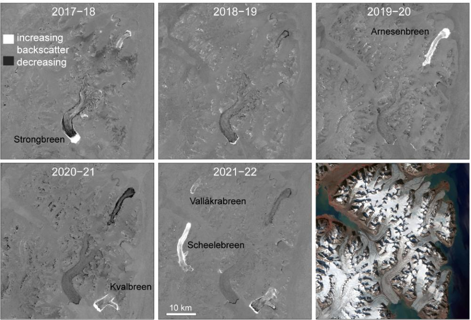
Glacier surges in Svalbard
This helped the team to test the analysis method and avoid confusion with other events that impact glacier surface roughness, such as deposits from snow avalanches.
In total the team detected some 115 glaciers surges; interestingly, most of these events were concentrated in three regions, the Tibet plateau, Svalbard in Norway, and Yukon in Alaska.
Andreas Kääb, lead author of the study, explains, “This is the first time that glaciers surges have been mapped globally in a consistent way, and including timing information to show when these events happened. This gives us a number of new insights and possibilities for further research. In my view, though, the most surprising result is that the discovered surges were concentrated in just a few areas.
Glacier surge in southern Svalbard
“While climate change – in particular rising air temperatures and changes in snow fall – could have caused the geographic surge clusters that we found, we need longer time series of glacier surge maps to closer investigate this theory. The long-term perspective and consistency of the Copernicus Sentinel missions is therefore of key importance for us.”
The project was supported by ESA’s Climate Change Initiative and performed in preparation for ESA’s tenth Earth Explorer, Harmony.
Source:
Copernicus. (2023, August 31). Glacier surges mapped globally from space. Sentinel Success Stories - Sentinel Online.