Publié le 28 septembre 2026
Beneath Greenland’s vast ice sheet lies a landscape of mountains and valleys that no human has ever seen directly. A new NASA-led mapping method is now revealing that hidden terrain in unprecedented detail.
Scientists used subtle variations in the ice surface to infer what lies kilometres below. As ice flows over buried ridges and valleys, the topography leaves a faint signature on the surface that can be detected by satellites.
The resulting map identifies 1,943 valleys beneath the Greenland Ice Sheet, around one third of them newly mapped. Many previously known valleys also appear to extend much farther inland than earlier maps suggested.
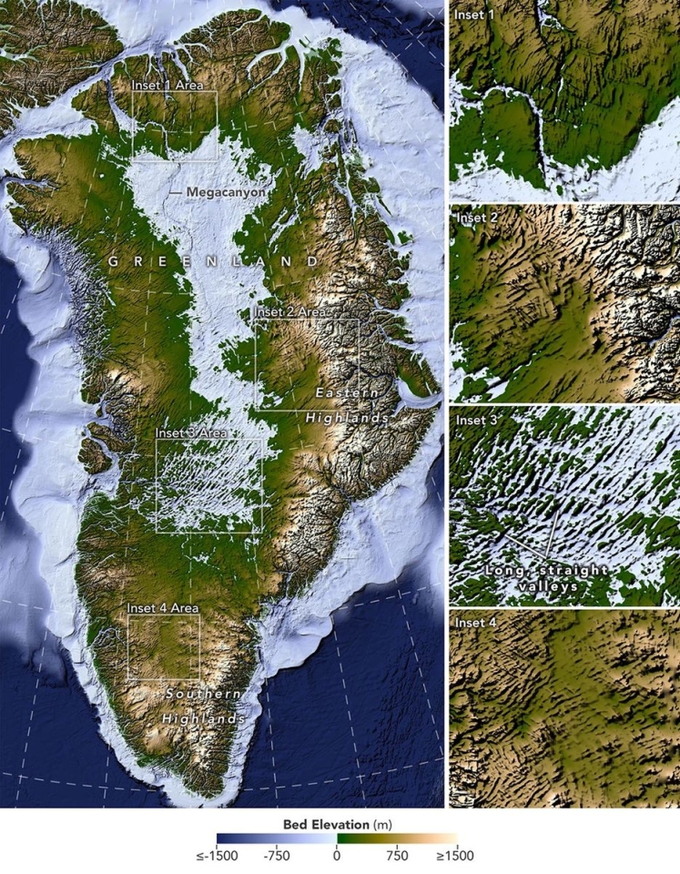
A new map reveals an extensive network of valleys hidden beneath the Greenland Ice Sheet, including long, remarkably straight valleys in the west-central part of the island.
Image: NASA Earth Observatory/Lauren Dauphin, based on data from Chartrand et al.
These buried valleys are more than geological curiosities. They help control how ice moves across Greenland: ice tends to concentrate in valleys, where thicker and faster-flowing glaciers can further deepen the landscape beneath them.
The map also offers clues to Greenland’s distant past. Some valleys appear to predate the ice sheet itself, while others have shapes that may point to ancient tectonic structures or groundwater-driven erosion. Understanding this hidden landscape can also improve models of how the ice sheet may retreat in the future.
Based on: NASA Earth Observatory, Uncovering the Valleys Hidden Below Greenland’s Ice, 28 September 2026.