Publié le 7 décembre 2023
Data disseminated by ESA’s Third Party Missions (TPM) programme are enabling archaeological investigations that could help to unravel the mysteries of past societies and cultures.
In recent decades, remote sensing has emerged as a crucial asset for the field of archaeology, resulting in many new findings and improving understanding of previously discovered historic sites.

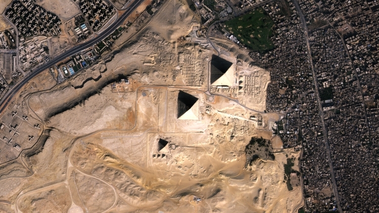
Vision-1 captures the Pyramids of Giza
The orbital perspective of Earth observing satellites allows researchers to identify, monitor and analyse areas of interest all around the world, all while minimising the impact on the fragile relics they contain.
High resolution optical imagery and radar observations delivered by commercial missions have huge potential for such applications, but these data are often locked behind a paywall, which can limit their use in research.
Through its TPM programme, ESA addresses this challenge by disseminating data from privately owned missions on a free basis for research and development purposes.
High resolution optical missions
Of particular importance is high resolution optical imagery, which is essential to archaeological studies that involve the detailed inspection of structures and landscapes.

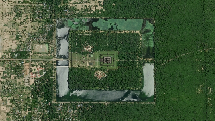
SkySat captures Angkor Wat in Cambodia
TPMs that are currently providing high resolution or very high resolution imagery for use in archaeological research include:
- Planet’s SkySat and PlanetScope missions
- The WorldView series, GeoEye-1, and QuickBird-2, owned by Maxar
- The Pléiades and the Pléiades Neo constellations, from Airbus Defence and Space
- SPOT-6 and SPOT-7, also operated by Airbus Defence and Space
The projects being completed cover many different areas, such as assessing the impact of modern activities on ancient sites, detecting traces of past human activities, supporting citizen science initiatives, and many more.
In one project, for instance, very high resolution data from SkySat, Pléiades, Pléiades Neo and WorldView-2 are supporting the development of a process to detect features of potential interest, such as the remnants of ancient road networks and canals, or natural features like paleochannels.
Synthetic aperture radar data
High resolution synthetic aperture radar missions – which can continue to gather data day and night, and under all weather conditions – also have a growing role in archaeology.
Synthetic aperture radar TPMs that are currently supporting such projects include:
- The Finnish ICEYE constellation
- The TerraSAR-X and TanDEM-X radar satellites, from the German Aerospace Center (DLR)
Data from these missions have many potential uses and, in one project, TanDEM-X observations are being applied in research into hunter gatherer mobility, and habitat reconstruction.
ow to access the data
Data from the TPMs highlighted here can be requested from ESA’s Data Dissemination Service.
You can request the following datasets via the project proposals process, which can take up to six weeks to be evaluated:
- TerraSAR-X/TanDEM-X full archive and tasking
- ICEYE full archive and tasking
- SkySat full archive and new tasking
- QuickBird full archive
- GeoEye-1 full archive and tasking
- PlanetScope full archive
- SPOT 6 to 7 full archive and tasking
- Pléiades full archive and tasking
- Pléiades Neo full archive and tasking
You can access the following dataset via the fast registration with approval process, which takes a few days to be evaluated:
Source:
European Space Agency. (2023, December 4). How to use space data to probe humankind’s ancient past. Earth Online.