Publié le 6 mai 2024
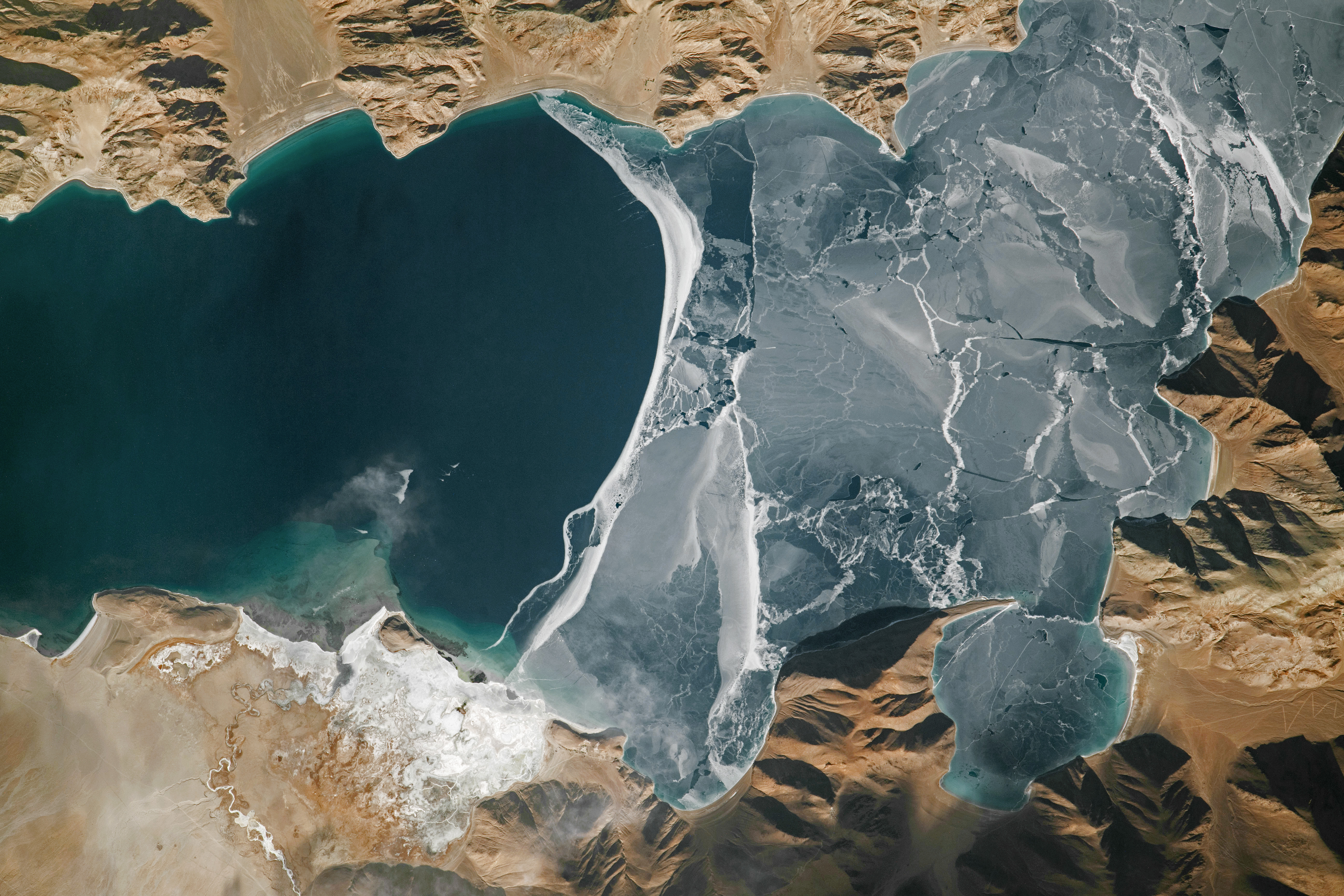
A crew member aboard the International Space Station took this photo of a 15-kilometer (9.5-mile) section of Pangong Lake (Pangong Tso) on the western end of the Tibetan Plateau. In total, the lake extends 134 kilometers (83 miles) and spans the international border between India and China. The lake is one of the highest in the world, at an elevation of 4,225 meters (13,862 feet).

In this winter scene, a sheet of cracked ice tops part of the lake (right side of the image). On the left side, open water appears blue. Shallow water offshore of a delta, formed by a small, winding river, appears green.
Parallel lines along the coastlines of bays are visible in the high-resolution version of this image. These lines indicate raised beaches, which formed in the past when lake levels were higher.
Several roads cut across the landscape, including one with switchbacks that ascends a steep slope. These roads facilitate tourist travel from both India and China. During the summer, species such as bar-headed geese and Brahminy ducks attract bird watchers to the lake, which is a major breeding ground for migrating birds.
Source:
NASA Earth Observatory. (May 5, 2024). Pangong Lake in winter. https://earthobservatory.nasa.gov/images/152768/pangong-lake-in-winter