Publié le 9 novembre 2021
The research, published in the journal Environmental Research Letters, describes how the visible traces of human presence, or ‘human footprint’, across the Arctic’s land, which is prone to thaw, has increased by 15% during the last two decades.
Permafrost is frozen soil, rock or sediment – sometimes hundreds of metres thick. To be classified as permafrost, the ground has to have been frozen for at least two years, but much of the sub-surface ground in the polar regions has remained frozen since the ice age.
Permafrost holds carbon-based remains of vegetation and animals that froze before decomposition could set in. Rising global temperatures are causing permafrost to thaw and release long-held methane and carbon dioxide to the atmosphere. This thawing process is also destabilising the ground, affecting infrastructure such as roads, pipelines and buildings.
Annett Bartsch, from b.geos GmbH and member of ESA’s Climate Change Initiative Permafrost Project, said, “We used Climate Change Initiative permafrost ground-temperature trends going back to 1997 and extrapolated them to 2050, allowing us to predict where the temperature of the ground, down to a depth of two metres, will be over 0°C by 2050. We see that 55% of the infrastructure currently located on permafrost and within 100 km of the Arctic coastline – infrastructure on which communities rely – is likely to be affected.”
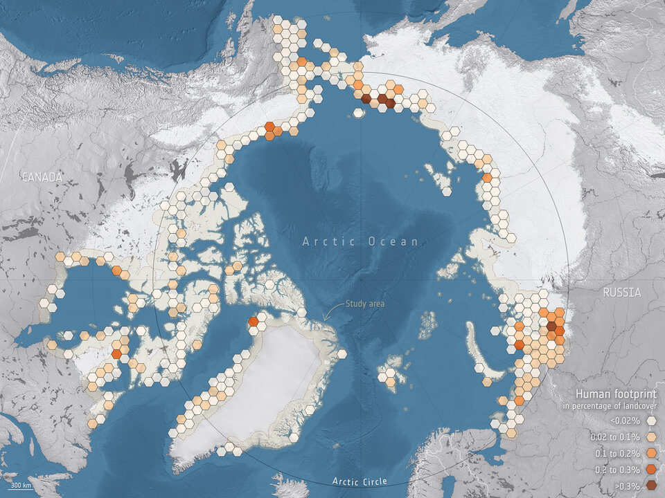
— At risk of thawing permafrost
Developed by the European Space Agency and its Member States, the Climate Change Initiative generates robust, long-term global satellite datasets for over 21 key components of the Earth system. Observations from ESA’s 40-year satellite archive as well as current ESA missions, the Copernicus Sentinels and ESA third-party missions all contribute to these datasets, known as Essential Climate Variables.
“We then used high-resolution data from the Copernicus Sentinel-1 mission, which carries an advanced radar instrument, and data from the Copernicus Sentinel-2 mission, which carries a camera-like instrument, along with artificial intelligence to identify communities and assets that are vulnerable to thawing permafrost,” continued Dr Bartsch.