Publié le 12 septembre 2022
Researchers have used Copernicus Sentinel imagery collected over Peru to track the production of asparagus, a major Peruvian farming export that is widely consumed in Europe.
They hope this will inform improved decision-making and build resilience into the asparagus supply chain, benefiting local farmers, the environment and ensuring less food waste between farm and table.
While asparagus season in northern Europe is popularly celebrated from April to the summer solstice, year-round supplies of asparagus are grown in equatorial regions.
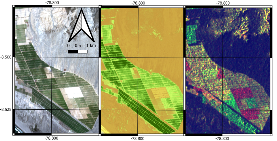
These images show the asparagus fields in different stages of growth. For every pixel in the image the dynamic filtering algorithm tracks the amount of carbohydrate in the crops. Left: Sentinel-2 RGB image acquired 04/01/2019; Centre: Sentinel-2 GNDVI image; Right: Sentinel-1 RGB Composite.
Peru is one of the largest exporters of asparagus in the world and the second-largest producer after China. The asparagus crop is a cornerstone in the Peruvian agricultural sector and is extensively consumed in Europe.
A new method for up-to-date monitoring and forecasting of Peruvian asparagus crops has been developed, using a fusion of Copernicus Sentinel-1 synthetic aperture radar (SAR) data with Copernicus Sentinel-2 optical data, to help reduce losses in the asparagus supply chain.
Research based at the University of Stirling, UK, drew on data delivered by both Sentinel-1 and Sentinel-2 of the European Union’s Copernicus Programme and targeted asparagus fields located in the Peruvian north coast – a total of 432 agricultural parcels.