Publié le 2 août 2021
In 2000, atmospheric scientists from the U.S. Naval Research Laboratory (NRL) first reported that smoke plumes from intense wildfires could spawn towering thunderstorms that channeled smoke as high or higher than the cruising altitude of jets. These pyrocumulonimbus, or pyroCb, events wowed scientists at the time. Prior to that discovery, only explosive volcanic eruptions and extreme thunderstorms were thought to be capable of lofting material so high.
Though the workings of these smoke-infused storm clouds have come into clearer focus, their increasingly extreme behavior in recent years has surprised and worried some scientists who track them. The latest encounters with these fire-breathing smoke clouds came in North America in June and July 2021 during an unusually warm fire season that arrived early in Canadian and U.S. forests.
 July 15, 2021
Michael Fromm and David Peterson of NRL and a team of colleagues from NASA and several other institutions have used the Advanced Baseline Imager (ABI) on the NOAA-NASA GOES weather satellites, as well as sensors on other satellites, to identify 61 pyroCbs in North America this year as of July 29, 2021, about the halfway point of the fire season.
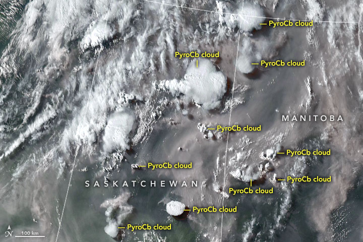
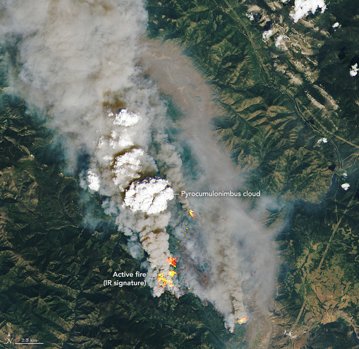
Their observations included a remarkable outbreak of 10 pyroCbs along the Saskatchewan-Manitoba border on July 16. It was more of the wildfire smoke storms than scientists have ever observed in North America on a single day since they started tracking all of them with satellites in 2013. In the ABI image shown above, all of the marked clouds ended up generating PyroCbs, though some were still in the pyrocumulus (pyroCu) stage when the image was taken. The image below shows an example of a small pyroCb rising above the McKay Creek fire on June 30, 2021.
 June 30, 2021
The July outbreak came two weeks after another unusual event—what Fromm called a “monster pyroCb” that exploded on June 30 above the Sparks Lake fire in western Canada. A storm cell grew over a forest fire in British Columbia and spread across more than 160,000 square kilometers (62,000 square miles), an area slightly larger than the state of Georgia.
As it spread out, it sent a chimney of smoke up to 16 kilometers (10 miles), according to data collected by the Multi-angle Imaging SpectroRadiometer (MISR) on NASA’s Terra satellite. Meanwhile, a GOES satellite observed the storm unleashing extraordinary bursts of lightning. After watching satellite clips of the storm blowing up and smoke spreading widely as updrafts hit the stratosphere, one meteorologist characterized the cloud’s behavior as “absolutely mind blowing.”